UN
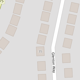
54 Glenton Way
£ 340,000
Description
We don't have a Description for this property.
- Bedrooms
- 3
- Bathrooms
- 0


Leaflet © OpenStreetMap contributors
The heatmap indicates the level of crime in the area. The color of the heatmap indicates the crime severity and recency.
Metrics Year-on-Year
- Average area value
- 744,333.00 £Increased by 18.53 %
- Average area rental value
- 1,770.00 £/moDecreased by 1.28 %
- Est rental Yield
- 2.85 %Decreased by 16.91 %
- Crime Rate
- 12.00 %Unchanged by 0.00 %
from 627,970.00 £
from 1,793.00 £/mo
from 3.43 %
from 12.00 %
Nearby Schools
| Name | Type | Ofsted | Distance |
|---|---|---|---|
| Bower Park Academy | Academy Converter | Good | 0.33 KM |
| Rise Park Junior School | Academy Sponsor Led | Good | 0.70 KM |
| Rise Park Infant School | Academy Converter | Good | 0.70 KM |
| Immanuel School | Other Independent School | 0.80 KM | |
| Marshalls Park Academy | Academy Converter | Good | 1.41 KM |
Images
Nearby Streets
| Name | Average Price | Average Sqft | Distance |
|---|---|---|---|
| Cree Way | £ 0 | 0 | 0.00 KM |
| The Drive | £ 350,000 | 0 | 0.00 KM |
| The Drive | £ 531,250 | 0 | 0.00 KM |
| Rawdin Close | £ 0 | 0 | 0.00 KM |
| Vernon Road | £ 0 | 0 | 0.00 KM |
Nearby Transport
| Name | NLC | TLC | Distance |
|---|---|---|---|
| Romford | 6886 | RMF | 3.08 KM |
| Gidea Park | 6877 | GDP | 3.60 KM |
| Emerson Park | 7473 | EMP | 5.75 KM |
| Harold Wood | 6879 | HRO | 5.90 KM |
| Chadwell Heath | 6874 | CTH | 6.88 KM |
Nearby Listings
| Address | Price | Type | Score | Distance |
|---|---|---|---|---|
| Havering Road, Romford | £ 525,000 | BUY | 7 / 10 | 0.07 KM |
| Glenton Way, Rise Park, RM1 | £ 500,000 | BUY | Unknown | 0.10 KM |
| Campbell Close, Romford, RM1 | £ 725,000 | BUY | 8 / 10 | 0.10 KM |
| Chaseside Close, Romford, Essex | £ 500,000 | BUY | 5 / 10 | 0.11 KM |
| Chaseside Close, Romford, Essex | £ 330,500 | BUY | 5 / 10 | 0.11 KM |
Nearby Properties
| Address | Price | Distance |
|---|---|---|
| 63 Glenton Way | £ 367,000 | 0.00 KM |
| 56 Glenton Way | £ 332,500 | 0.00 KM |
| 54 Glenton Way | £ 340,000 | 0.00 KM |
| 61 Glenton Way | £ 367,500 | 0.00 KM |
| 58 Glenton Way | £ 225,000 | 0.02 KM |