UN
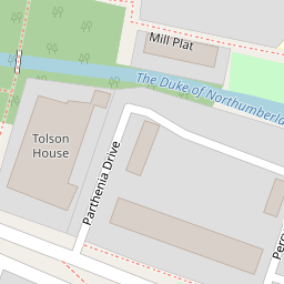
8 Mill Plat
£ 550,000
Description
We don't have a Description for this property.
- Bedrooms
- 4
- Bathrooms
- 0


Leaflet © OpenStreetMap contributors
The heatmap indicates the level of crime in the area. The color of the heatmap indicates the crime severity and recency.
Metrics Year-on-Year
- Average area value
- 480,053.00 £Decreased by 15.57 %
- Average area rental value
- 1,807.00 £/moDecreased by 21.26 %
- Est rental Yield
- 4.52 %Decreased by 6.61 %
- Crime Rate
- 2.00 %Unchanged by 0.00 %
from 568,561.00 £
from 2,295.00 £/mo
from 4.84 %
from 2.00 %
Nearby Schools
| Name | Type | Ofsted | Distance |
|---|---|---|---|
| The Blue School Cofe Primary | Voluntary Aided School | Outstanding | 0.26 KM |
| St Mary'S Catholic Primary School, Isleworth | Voluntary Aided School | Good | 0.45 KM |
| Worple Primary School | Community School | Good | 0.63 KM |
| Isleworth Town Primary School | Community School | Good | 0.68 KM |
| The Smallberry Green Primary School | Community School | Good | 0.69 KM |
Images
Nearby Streets
| Name | Average Price | Average Sqft | Distance |
|---|---|---|---|
| Magdala Road | £ 0 | 0 | 0.00 KM |
| Van Gogh Close | £ 399,950 | 0 | 0.00 KM |
| Lodge Close | £ 0 | 0 | 0.00 KM |
| Hartham Road | £ 450,000 | 0 | 0.00 KM |
| St. John's Road | £ 419,163 | 0 | 0.00 KM |
Nearby Transport
| Name | NLC | TLC | Distance |
|---|---|---|---|
| Syon Lane | 5609 | SYL | 1.18 KM |
| Isleworth | 5592 | ISL | 1.53 KM |
| St Margarets | 5604 | SMG | 1.82 KM |
| Brentford | 5552 | BFD | 2.38 KM |
| Twickenham | 5574 | TWI | 2.48 KM |
Nearby Listings
| Address | Price | Type | Score | Distance |
|---|---|---|---|---|
| Isleworth, TW7 | £ 2,799,999 | BUY | 7 / 10 | 0.03 KM |
| White Lodge Close, Isleworth, TW7 | £ 410,000 | BUY | 7 / 10 | 0.08 KM |
| White Lodge Close, Old Isleworth | £ 369,950 | BUY | 7 / 10 | 0.09 KM |
| Percy Gardens, Isleworth | £ 365,000 | BUY | Unknown | 0.09 KM |
| Millside Place, Old Isleworth, TW7 | £ 1,125,000 | BUY | 8 / 10 | 0.11 KM |
Nearby Properties
| Address | Price | Distance |
|---|---|---|
| 8 Mill Plat | £ 550,000 | 0.00 KM |
| 1 Mill Plat | £ 900,000 | 0.00 KM |
| 2 Mill Plat | £ 849,950 | 0.00 KM |
| 7 Mill Plat | £ 855,000 | 0.00 KM |
| 14 Percy Gardens | £ 374,000 | 0.10 KM |