UN
174 Kirkdale
£ 122,000
Description
We don't have a Description for this property.
- Bedrooms
- 2
- Bathrooms
- 0

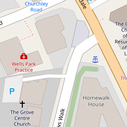
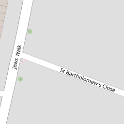


Leaflet © OpenStreetMap contributors
The heatmap indicates the level of crime in the area. The color of the heatmap indicates the crime severity and recency.
Metrics Year-on-Year
- Average area value
- 521,464.00 £Decreased by 2.12 %
- Average area rental value
- 1,961.00 £/moIncreased by 6.98 %
- Est rental Yield
- 4.51 %Increased by 9.20 %
- Crime Rate
- 3.00 %Unchanged by 0.00 %
from 532,762.00 £
from 1,833.00 £/mo
from 4.13 %
from 3.00 %
Nearby Schools
| Name | Type | Ofsted | Distance |
|---|---|---|---|
| St Bartholomews'S Church Of England Primary School | Voluntary Aided School | Good | 0.46 KM |
| Sydenham School | Community School | Good | 0.56 KM |
| Kelvin Grove Primary School | Community School | Good | 0.57 KM |
| Kelvin Grove Children'S Centre | Children's Centre | 0.58 KM | |
| Sydenham High School Gdst | Other Independent School | 0.67 KM |
Images
Nearby Streets
| Name | Average Price | Average Sqft | Distance |
|---|---|---|---|
| Chulsa Road | £ 340,000 | 0 | 0.00 KM |
| Peter's Path | £ 375,000 | 0 | 0.00 KM |
| Logue Walk | £ 315,000 | 0 | 0.00 KM |
| Grizedale Terrace | £ 383,333 | 0 | 0.00 KM |
| King Garth Mews | £ 674,975 | 0 | 0.00 KM |
Nearby Transport
| Name | NLC | TLC | Distance |
|---|---|---|---|
| Sydenham | 5437 | SYD | 0.56 KM |
| Penge East | 5072 | PNE | 1.22 KM |
| Forest Hill | 5362 | FOH | 1.29 KM |
| Penge West | 5378 | PNW | 1.31 KM |
| Crystal Palace | 5356 | CYP | 1.96 KM |
Nearby Listings
| Address | Price | Type | Score | Distance |
|---|---|---|---|---|
| Homewalk House, Jews Walk, London | £ 225,000 | BUY | 7 / 10 | 0.12 KM |
| Homewalk House, Jews Walk, London | £ 100,000 | BUY | 5 / 10 | 0.12 KM |
| Peak Hill, London | £ 375,000 | BUY | 7 / 10 | 0.13 KM |
| Homewalk House, Jews Walk, SE26 | £ 110,000 | BUY | 6 / 10 | 0.13 KM |
| Kirkdale, London, SE26 | £ 275,000 | BUY | 5 / 10 | 0.21 KM |
Nearby Properties
| Address | Price | Distance |
|---|---|---|
| 174 Kirkdale | £ 122,000 | 0.00 KM |
| 213a Kirkdale | £ 275,000 | 0.09 KM |
| 221 Kirkdale | £ 432,500 | 0.09 KM |
| 219a Kirkdale | £ 157,000 | 0.09 KM |
| 209 Kirkdale | £ 342,500 | 0.09 KM |