UN
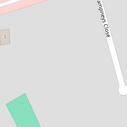
8 Champneys Close
£ 725,000
Description
We don't have a Description for this property.
- Bedrooms
- 3
- Bathrooms
- 0
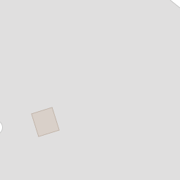

Leaflet © OpenStreetMap contributors
The heatmap indicates the level of crime in the area. The color of the heatmap indicates the crime severity and recency.
Metrics Year-on-Year
- Average area value
- 906,511.00 £Decreased by 10.54 %
- Average area rental value
- 2,414.00 £/moIncreased by 3.03 %
- Est rental Yield
- 3.20 %Increased by 15.52 %
- Crime Rate
- 6.00 %Unchanged by 0.00 %
from 1,013,333.00 £
from 2,343.00 £/mo
from 2.77 %
from 6.00 %
Nearby Schools
| Name | Type | Ofsted | Distance |
|---|---|---|---|
| St Dunstan'S Cheam Cofe Primary School | Voluntary Aided School | Good | 0.75 KM |
| Cuddington Croft Primary School | Academy Converter | Good | 0.76 KM |
| Nonsuch High School For Girls | Academy Converter | Good | 1.24 KM |
| Avenue Primary Academy | Academy Converter | 1.29 KM | |
| Thomas Wall Nursery Children'S Centre (Sutton Central West) | Children's Centre | 1.32 KM |
Images
Nearby Streets
| Name | Average Price | Average Sqft | Distance |
|---|---|---|---|
| Hillside Road | £ 0 | 0 | 0.00 KM |
| Stafford Close | £ 900,000 | 0 | 0.00 KM |
| Church Farm Road | £ 0 | 0 | 0.00 KM |
| Cornwall Road | £ 1,272,500 | 0 | 0.00 KM |
| Worcester Road | £ 1,500,000 | 0 | 0.00 KM |
Nearby Transport
| Name | NLC | TLC | Distance |
|---|---|---|---|
| Cheam | 5352 | CHE | 0.20 KM |
| West Sutton | 5293 | WSU | 1.52 KM |
| Belmont | 5350 | BLM | 1.94 KM |
| Sutton | 5385 | SUO | 2.45 KM |
| Banstead | 5348 | BAD | 2.79 KM |
Nearby Listings
| Address | Price | Type | Score | Distance |
|---|---|---|---|---|
| Champneys Close, South Cheam | £ 1,500,000 | BUY | 8 / 10 | 0.07 KM |
| Station Approach, Cheam | £ 250,000 | BUY | 6 / 10 | 0.12 KM |
| Station Approach, Cheam, Sutton, SM2 | £ 350,000 | BUY | 5 / 10 | 0.15 KM |
| Station Approach, Cheam, Sutton, SM2 | £ 250,000 | BUY | 5 / 10 | 0.15 KM |
| Station Approach, Cheam, Sutton, SM2 | £ 265,000 | BUY | 7 / 10 | 0.15 KM |
Nearby Properties
| Address | Price | Distance |
|---|---|---|
| 7 Champneys Close | £ 1,150,000 | 0.00 KM |
| 8 Champneys Close | £ 725,000 | 0.00 KM |
| 9 Champneys Close | £ 1,550,000 | 0.00 KM |
| 5 Champneys Close | £ 935,000 | 0.00 KM |
| 11 Champneys Close | £ 875,000 | 0.00 KM |