UN
32 Lumley Road
£ 229,000
Description
We don't have a Description for this property.
- Bedrooms
- 3
- Bathrooms
- 0
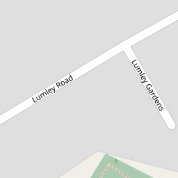

Leaflet © OpenStreetMap contributors
The heatmap indicates the level of crime in the area. The color of the heatmap indicates the crime severity and recency.
Metrics Year-on-Year
- Average area value
- 906,511.00 £Decreased by 10.54 %
- Average area rental value
- 2,414.00 £/moIncreased by 3.03 %
- Est rental Yield
- 3.20 %Increased by 15.52 %
- Crime Rate
- 13.00 %Unchanged by 0.00 %
from 1,013,333.00 £
from 2,343.00 £/mo
from 2.77 %
from 13.00 %
Nearby Schools
| Name | Type | Ofsted | Distance |
|---|---|---|---|
| Cheam Fields Primary Academy | Academy Converter | Good | 0.49 KM |
| Cheam High School | Academy Converter | Outstanding | 0.53 KM |
| St Dunstan'S Cheam Cofe Primary School | Voluntary Aided School | Good | 0.67 KM |
| Nonsuch High School For Girls | Academy Converter | Good | 1.10 KM |
| Cuddington Croft Primary School | Academy Converter | Good | 1.23 KM |
Images
Nearby Streets
| Name | Average Price | Average Sqft | Distance |
|---|---|---|---|
| Stafford Close | £ 900,000 | 0 | 0.00 KM |
| Osprey Close | £ 0 | 0 | 0.00 KM |
| Hillside Road | £ 0 | 0 | 0.00 KM |
| Esher Avenue | £ 587,500 | 0 | 0.00 KM |
| The Meads | £ 0 | 0 | 0.00 KM |
Nearby Transport
| Name | NLC | TLC | Distance |
|---|---|---|---|
| Cheam | 5352 | CHE | 0.75 KM |
| West Sutton | 5293 | WSU | 1.31 KM |
| Sutton Common | 5436 | SUC | 2.64 KM |
| Belmont | 5350 | BLM | 2.79 KM |
| Sutton | 5385 | SUO | 2.79 KM |
Nearby Listings
| Address | Price | Type | Score | Distance |
|---|---|---|---|---|
| Cookes Lane, Sutton | £ 625,000 | BUY | Unknown | 0.13 KM |
| St. Dunstans Hill, Cheam, Sutton, SM1 | £ 850,000 | BUY | 7 / 10 | 0.19 KM |
| Malden Road, Cheam, Sutton, SM3 | £ 400,000 | BUY | Unknown | 0.20 KM |
| Fromondes Road, Cheam, | £ 600,000 | BUY | 6 / 10 | 0.20 KM |
| St. Dunstans Hill, Cheam, Sutton, SM1 | £ 750,000 | BUY | 7 / 10 | 0.23 KM |
Nearby Properties
| Address | Price | Distance |
|---|---|---|
| 38 Lumley Road | £ 350,000 | 0.00 KM |
| 26 Lumley Road | £ 605,000 | 0.00 KM |
| 28 Lumley Road | £ 608,000 | 0.00 KM |
| 18 Lumley Road | £ 280,000 | 0.00 KM |
| 32 Lumley Road | £ 229,000 | 0.00 KM |