UN
146 Ridge Road
£ 210,000
Description
We don't have a Description for this property.
- Bedrooms
- 2
- Bathrooms
- 0
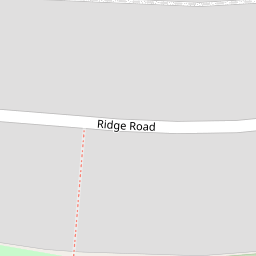

Leaflet © OpenStreetMap contributors
The heatmap indicates the level of crime in the area. The color of the heatmap indicates the crime severity and recency.
Metrics Year-on-Year
- Average area value
- 551,806.00 £Increased by 7.82 %
- Average area rental value
- 2,200.00 £/moIncreased by 10.33 %
- Est rental Yield
- 4.78 %Increased by 2.14 %
- Crime Rate
- 3.00 %Unchanged by 0.00 %
from 511,800.00 £
from 1,994.00 £/mo
from 4.68 %
from 3.00 %
Nearby Schools
| Name | Type | Ofsted | Distance |
|---|---|---|---|
| Brookfield Primary Academy | Academy Converter | Good | 0.36 KM |
| Cheam Park Farm Primary Academy | Academy Converter | Outstanding | 0.64 KM |
| St Cecilia'S Catholic Primary School | Voluntary Aided School | Outstanding | 1.13 KM |
| Green Oak Children'S Centre (Formally Nonsuch And Cheam Sure Start Children'S Centre) | Children's Centre | 1.16 KM | |
| Green Oak Children'S Centre (Formally Stonecot And Worcester Park Children'S Centre) | Children's Centre | 1.16 KM |
Images
Nearby Streets
| Name | Average Price | Average Sqft | Distance |
|---|---|---|---|
| Poplar Road | £ 606,250 | 0 | 0.00 KM |
| Beeches Road | £ 465,438 | 0 | 0.00 KM |
| St Cecilia's Close | £ 0 | 0 | 0.00 KM |
| Westbourne Avenue | £ 1,990,000 | 0 | 0.00 KM |
| Trafalgar Avenue | £ 396,250 | 0 | 0.00 KM |
Nearby Transport
| Name | NLC | TLC | Distance |
|---|---|---|---|
| West Sutton | 5293 | WSU | 1.76 KM |
| Sutton Common | 5436 | SUC | 1.84 KM |
| St Helier | 5290 | SIH | 1.84 KM |
| Morden South | 5291 | MDS | 2.27 KM |
| South Merton | 5292 | SMO | 2.67 KM |
Nearby Listings
| Address | Price | Type | Score | Distance |
|---|---|---|---|---|
| Ridge Road, Sutton | £ 425,000 | BUY | Unknown | 0.03 KM |
| Ridge Road, Sutton, Surrey. SM3 | £ 550,000 | BUY | 6 / 10 | 0.03 KM |
| Burleigh Road, Sutton, Surrey | £ 650,000 | BUY | 6 / 10 | 0.11 KM |
| Ridge Road, Sutton, SM3 | £ 425,000 | BUY | 7 / 10 | 0.18 KM |
| Beeches Road, Sutton, SM3 | £ 575,000 | BUY | 6 / 10 | 0.22 KM |
Nearby Properties
| Address | Price | Distance |
|---|---|---|
| 146 Ridge Road | £ 210,000 | 0.00 KM |
| 162 Ridge Road | £ 247,500 | 0.00 KM |
| 180 Ridge Road | £ 337,000 | 0.00 KM |
| 150 Ridge Road | £ 325,000 | 0.00 KM |
| 174 Ridge Road | £ 277,000 | 0.00 KM |