UN
26 Dunelm
£ 95,000
Description
We don't have a Description for this property.
- Bedrooms
- 4
- Bathrooms
- 0
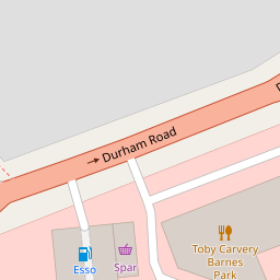


Leaflet © OpenStreetMap contributors
The heatmap indicates the level of crime in the area. The color of the heatmap indicates the crime severity and recency.
Metrics Year-on-Year
- Average area value
- 930,241.00 £Decreased by 11.97 %
- Average area rental value
- 3,908.00 £/moIncreased by 1.72 %
- Est rental Yield
- 5.04 %Increased by 15.60 %
- Crime Rate
- 2.00 %Unchanged by 0.00 %
from 1,056,720.00 £
from 3,842.00 £/mo
from 4.36 %
from 2.00 %
Nearby Schools
| Name | Type | Ofsted | Distance |
|---|---|---|---|
| Richard Avenue Primary School | Community School | Good | 0.12 KM |
| St Mary'S Catholic Primary School, Sunderland | Academy Converter | 0.54 KM | |
| Barbara Priestman Academy | Academy Special Converter | Good | 0.54 KM |
| City Of Sunderland College | Further Education | 0.82 KM | |
| Barnes Infant Academy | Academy Converter | Good | 0.96 KM |
Images
Nearby Streets
| Name | Average Price | Average Sqft | Distance |
|---|---|---|---|
| Wearhead Drive | £ 90,000 | 0 | 0.00 KM |
| Shirley Gardens | £ 287,500 | 0 | 0.00 KM |
| Eden House Road | £ 0 | 0 | 0.00 KM |
| Co-operative Terrace | £ 115,000 | 0 | 0.00 KM |
| Leamington Street | £ 180,000 | 0 | 0.00 KM |
Nearby Transport
| Name | NLC | TLC | Distance |
|---|---|---|---|
| Sunderland | 7640 | SUN | 2.47 KM |
| Seaham | 7814 | SEA | 8.62 KM |
Nearby Listings
| Address | Price | Type | Score | Distance |
|---|---|---|---|---|
| Dunelm, Barnes | £ 194,250 | BUY | 6 / 10 | 0.01 KM |
| Dunelm, Barnes | £ 290,000 | BUY | 6 / 10 | 0.02 KM |
| Georgian Court, Barnes, Sunderland | £ 249,950 | BUY | Unknown | 0.07 KM |
| Georgian Court, Barnes, Sunderland | £ 325,000 | BUY | 7 / 10 | 0.15 KM |
| Frinton Park, Barnes, Sunderland | £ 157,500 | BUY | 6 / 10 | 0.17 KM |
Nearby Properties
| Address | Price | Distance |
|---|---|---|
| 21 Dunelm | £ 212,000 | 0.00 KM |
| 27 Dunelm | £ 249,990 | 0.00 KM |
| 26 Dunelm | £ 95,000 | 0.00 KM |
| 35 Richard Avenue | £ 195,000 | 0.12 KM |
| 7 Richard Avenue | £ 198,000 | 0.12 KM |