UN
4 Tickford Bank
£ 272,800
Description
We don't have a Description for this property.
- Bedrooms
- 4
- Bathrooms
- 0
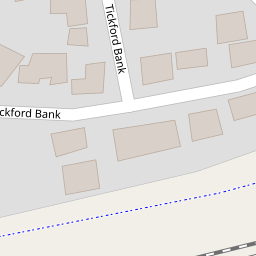

Leaflet © OpenStreetMap contributors
The heatmap indicates the level of crime in the area. The color of the heatmap indicates the crime severity and recency.
Metrics Year-on-Year
- Average area value
- 290,444.00 £Increased by 45.57 %
- Average area rental value
- 1,060.00 £/moIncreased by 29.74 %
- Est rental Yield
- 4.38 %Decreased by 10.79 %
- Crime Rate
- 5.00 %Unchanged by 0.00 %
from 199,519.00 £
from 817.00 £/mo
from 4.91 %
from 5.00 %
Nearby Schools
| Name | Type | Ofsted | Distance |
|---|---|---|---|
| Ditton Primary School | Academy Sponsor Led | 0.78 KM | |
| Saints Peter And Paul Catholic High School | Voluntary Aided School | Good | 0.84 KM |
| Chesnut Lodge Special School | Community Special School | Good | 0.96 KM |
| Ashley High School | Community Special School | Outstanding | 1.04 KM |
| Aspiring Foundations Federated Nursery Schools - Ditton Nursery School | Local Authority Nursery School | Good | 1.14 KM |
Images
Nearby Streets
| Name | Average Price | Average Sqft | Distance |
|---|---|---|---|
| Galway Avenue | £ 535,000 | 0 | 0.00 KM |
| Saint Mawes Close | £ 250,000 | 0 | 0.00 KM |
| Washington Close | £ 0 | 0 | 0.00 KM |
| Liverpool Road | £ 165,000 | 0 | 0.00 KM |
| Highfield Road | £ 149,950 | 0 | 0.00 KM |
Nearby Transport
| Name | NLC | TLC | Distance |
|---|---|---|---|
| Widnes | 2391 | WID | 1.55 KM |
| Hough Green | 2303 | HGN | 3.10 KM |
| Runcorn | 2291 | RUN | 4.38 KM |
| Rainhill | 2296 | RNH | 4.90 KM |
| Lea Green | 2339 | LEG | 6.05 KM |
Nearby Listings
| Address | Price | Type | Score | Distance |
|---|---|---|---|---|
| Maisemore Fields, Widnes | £ 565,000 | BUY | 7 / 10 | 0.13 KM |
| Maisemore Fields, Widnes | £ 575,000 | BUY | 7 / 10 | 0.13 KM |
| Wallsend Court, Widnes, WA8 | £ 225,000 | BUY | 6 / 10 | 0.29 KM |
| Wallsend Court,Widnes,WA8 9WE | £ 320,000 | BUY | 7 / 10 | 0.31 KM |
| Lynton Crescent, Widnes | £ 375,000 | BUY | 7 / 10 | 0.33 KM |
Nearby Properties
| Address | Price | Distance |
|---|---|---|
| 12 Tickford Bank | £ 362,500 | 0.00 KM |
| 22 Tickford Bank | £ 415,000 | 0.00 KM |
| 4 Tickford Bank | £ 272,800 | 0.00 KM |
| 35 Tickford Bank | £ 305,000 | 0.00 KM |
| 27 Tickford Bank | £ 570,000 | 0.00 KM |