UN
2 Oxton Close
£ 113,000
Description
We don't have a Description for this property.
- Bedrooms
- 2
- Bathrooms
- 0

Leaflet © OpenStreetMap contributors
The heatmap indicates the level of crime in the area. The color of the heatmap indicates the crime severity and recency.
Metrics Year-on-Year
- Average area value
- 222,105.00 £Increased by 27.39 %
- Average area rental value
- 751.00 £/moDecreased by 24.90 %
- Est rental Yield
- 4.06 %Decreased by 40.99 %
- Crime Rate
- 9.00 %Unchanged by 0.00 %
from 174,349.00 £
from 1,000.00 £/mo
from 6.88 %
from 9.00 %
Nearby Schools
| Name | Type | Ofsted | Distance |
|---|---|---|---|
| All Saints Upton Church Of England Voluntary Controlled Primary School | Voluntary Controlled School | Requires improvement | 0.44 KM |
| Upton Children'S Centre | Children's Centre | 0.68 KM | |
| Cronton Church Of England Primary Academy | Academy Converter | 1.05 KM | |
| St Basil'S Catholic Primary School | Voluntary Aided School | Good | 1.21 KM |
| Holy Family Catholic Primary School | Voluntary Aided School | Good | 1.31 KM |
Images
Nearby Streets
| Name | Average Price | Average Sqft | Distance |
|---|---|---|---|
| Danescroft | £ 0 | 0 | 0.00 KM |
| Rufford Close | £ 180,000 | 0 | 0.00 KM |
| Chapel Lane | £ 366,750 | 0 | 0.00 KM |
| Cherry Sutton | £ 0 | 0 | 0.00 KM |
| Kenley Avenue | £ 285,000 | 0 | 0.00 KM |
Nearby Transport
| Name | NLC | TLC | Distance |
|---|---|---|---|
| Hough Green | 2303 | HGN | 1.40 KM |
| Widnes | 2391 | WID | 3.77 KM |
| Rainhill | 2296 | RNH | 3.86 KM |
| Whiston | 2161 | WHN | 4.75 KM |
| Eccleston Park | 2227 | ECL | 5.56 KM |
Nearby Listings
| Address | Price | Type | Score | Distance |
|---|---|---|---|---|
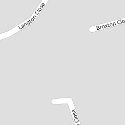
| Broxton Close, Widnes | £ 185,000 | BUY | 6 / 10 | 0.11 KM |
| Broxton Close, Widnes, WA8 | £ 120,000 | BUY | 6 / 10 | 0.12 KM |
| Langton Close, Widnes, WA8 4EA | £ 210,000 | BUY | 7 / 10 | 0.12 KM |
| Langton Close, Widnes, WA8 | £ 325,000 | BUY | 7 / 10 | 0.17 KM |
| Widnes, WA8 4TT | £ 95,000 | BUY | Unknown | 0.19 KM |
Nearby Properties
| Address | Price | Distance |
|---|---|---|
| 9 Oxton Close | £ 108,000 | 0.00 KM |
| 5 Oxton Close | £ 132,000 | 0.00 KM |
| 11 Oxton Close | £ 120,000 | 0.00 KM |
| 15 Oxton Close | £ 51,750 | 0.00 KM |
| 2 Oxton Close | £ 113,000 | 0.00 KM |