UN
4 Fern Bank
£ 393,000
Description
We don't have a Description for this property.
- Bedrooms
- 5
- Bathrooms
- 0
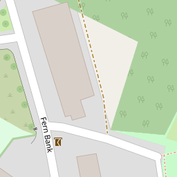

Leaflet © OpenStreetMap contributors
The heatmap indicates the level of crime in the area. The color of the heatmap indicates the crime severity and recency.
Metrics Year-on-Year
- Average area value
- 696,246.00 £Increased by 102.36 %
- Average area rental value
- 1,808.00 £/moIncreased by 16.49 %
- Est rental Yield
- 3.12 %Decreased by 42.33 %
- Crime Rate
- 1.00 %Unchanged by 0.00 %
from 344,071.00 £
from 1,552.00 £/mo
from 5.41 %
from 1.00 %
Nearby Schools
| Name | Type | Ofsted | Distance |
|---|---|---|---|
| St Joseph'S Catholic Primary School | Voluntary Aided School | Requires improvement | 0.22 KM |
| Fairfield Primary School | Academy Converter | Good | 0.22 KM |
| All Saints' Cofe School | Voluntary Controlled School | Good | 1.82 KM |
| Cockermouth School | Academy Converter | Good | 1.92 KM |
| Eaglesfield Paddle Cofe Primary Academy | Academy Converter | 2.96 KM |
Images
Nearby Streets
| Name | Average Price | Average Sqft | Distance |
|---|---|---|---|
| RomelyPlace | £ 199,950 | 0 | 0.00 KM |
| Smailes Court | £ 0 | 0 | 0.00 KM |
| The Croft | £ 160,000 | 0 | 0.00 KM |
| Mill Grove | £ 0 | 0 | 0.00 KM |
| Church Went | £ 215,000 | 0 | 0.00 KM |
Nearby Listings
| Address | Price | Type | Score | Distance |
|---|---|---|---|---|
| The Sidings, Cockermouth | £ 295,000 | BUY | Unknown | 0.23 KM |
| The Sidings, Cockermouth | £ 295,000 | BUY | Unknown | 0.23 KM |
| The Sidings, Cockermouth | £ 310,000 | BUY | 6 / 10 | 0.23 KM |
| 37 Mountain View, Cockermouth, Cumbria | £ 325,000 | BUY | 7 / 10 | 0.33 KM |
| Woodville Park, Cockermouth | £ 168,000 | BUY | 7 / 10 | 0.34 KM |
Nearby Properties
| Address | Price | Distance |
|---|---|---|
| 14 Fern Bank | £ 500,000 | 0.00 KM |
| 7 Fern Bank | £ 365,000 | 0.00 KM |
| 4 Fern Bank | £ 393,000 | 0.00 KM |
| Rosebank | £ 389,950 | 0.00 KM |
| Muscat | £ 477,000 | 0.00 KM |