UN
152 Bell Lane
£ 39,000
Description
We don't have a Description for this property.
- Bedrooms
- 2
- Bathrooms
- 0
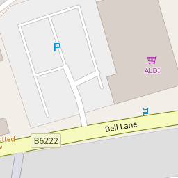

Leaflet © OpenStreetMap contributors
The heatmap indicates the level of crime in the area. The color of the heatmap indicates the crime severity and recency.
Metrics Year-on-Year
- Average area value
- 255,593.00 £Increased by 5.28 %
- Average area rental value
- 967.00 £/moDecreased by 2.22 %
- Est rental Yield
- 4.54 %Decreased by 7.16 %
- Crime Rate
- 0.00 %
from 242,775.00 £
from 989.00 £/mo
from 4.89 %
from 0.00 %
Nearby Schools
| Name | Type | Ofsted | Distance |
|---|---|---|---|
| St Paul'S Church Of England Primary School, Bury | Voluntary Aided School | Requires improvement | 0.38 KM |
| East Ward Community Primary School | Academy Converter | 0.45 KM | |
| Cambian Chesham House School | Other Independent Special School | Good | 0.49 KM |
| Hoyle Nursery School | Local Authority Nursery School | Outstanding | 0.54 KM |
| Bury East Children'S Centre Hub | Children's Centre | 0.56 KM |
Images
Nearby Streets
| Name | Average Price | Average Sqft | Distance |
|---|---|---|---|
| Rowan Drive | £ 175,000 | 0 | 0.00 KM |
| Gladstone Street | £ 0 | 0 | 0.00 KM |
| Back Lucas Street | £ 0 | 0 | 0.00 KM |
| Parsonage Close | £ 100,000 | 0 | 0.00 KM |
| Hawk Close | £ 0 | 0 | 0.00 KM |
Nearby Transport
| Name | NLC | TLC | Distance |
|---|---|---|---|
| Clifton (Manchester) | 2795 | CLI | 9.24 KM |
Nearby Listings
| Address | Price | Type | Score | Distance |
|---|---|---|---|---|
| Bell Lane, Bury, Greater Manchester, BL9 6DG | £ 170,000 | BUY | 5 / 10 | 0.00 KM |
| Pearson Street, Bury | £ 230,000 | BUY | 5 / 10 | 0.12 KM |
| Shaw Street, Bury, Greater Manchester, BL9 | £ 200,000 | BUY | 5 / 10 | 0.14 KM |
| Brighton Street, Bury | £ 170,000 | BUY | Unknown | 0.14 KM |
| Bell Lane, Bury, BL9 6HS | £ 160,000 | BUY | Unknown | 0.15 KM |
Nearby Properties
| Address | Price | Distance |
|---|---|---|
| 152 Bell Lane | £ 39,000 | 0.00 KM |
| 170 Bell Lane | £ 62,500 | 0.00 KM |
| 168 Bell Lane | £ 82,000 | 0.00 KM |
| 178 Bell Lane | £ 103,950 | 0.00 KM |
| 172 Bell Lane | £ 89,000 | 0.00 KM |