UN
11 Deeside
£ 140,000
Description
We don't have a Description for this property.
- Bedrooms
- 2
- Bathrooms
- 0


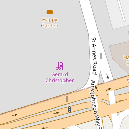
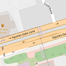

Leaflet © OpenStreetMap contributors
The heatmap indicates the level of crime in the area. The color of the heatmap indicates the crime severity and recency.
Metrics Year-on-Year
- Average area value
- 282,484.00 £Decreased by 4.09 %
- Average area rental value
- 1,117.00 £/moIncreased by 0.27 %
- Est rental Yield
- 4.75 %Increased by 4.63 %
- Crime Rate
- 1.00 %Unchanged by 0.00 %
from 294,539.00 £
from 1,114.00 £/mo
from 4.54 %
from 1.00 %
Nearby Schools
| Name | Type | Ofsted | Distance |
|---|---|---|---|
| Highfield Leadership Academy | Academy Sponsor Led | Requires improvement | 0.84 KM |
| Roseacre Primary Academy | Academy Converter | 0.97 KM | |
| Hawes Side Academy | Academy Converter | Good | 1.08 KM |
| Highfield Children'S Centre | Children's Centre Linked Site | 1.16 KM | |
| Our Lady Of The Assumption Catholic Primary School | Voluntary Aided School | Good | 1.20 KM |
Images
Nearby Streets
| Name | Average Price | Average Sqft | Distance |
|---|---|---|---|
| Abbey Road | £ 107,475 | 0 | 0.00 KM |
| Highfield Road | £ 145,000 | 0 | 0.00 KM |
| Emerson Avenue | £ 0 | 0 | 0.00 KM |
| Whitwell Avenue | £ 0 | 0 | 0.00 KM |
| Regal Avenue | £ 110,000 | 0 | 0.00 KM |
Nearby Transport
| Name | NLC | TLC | Distance |
|---|---|---|---|
| Squires Gate | 2666 | SQU | 1.90 KM |
| Blackpool Pleasure Beach | 2738 | BPB | 2.33 KM |
| Blackpool South | 2740 | BPS | 2.52 KM |
| St Annes-On-The-Sea | 2672 | SAS | 3.24 KM |
| Blackpool North | 2739 | BPN | 4.77 KM |
Nearby Listings
| Address | Price | Type | Score | Distance |
|---|---|---|---|---|
| Deeside, Blackpool, FY4 | £ 200,000 | BUY | 6 / 10 | 0.02 KM |
| Balham Avenue, Blackpool, FY4 | £ 180,000 | BUY | Unknown | 0.12 KM |
| Ivy Avenue, Blackpool | £ 145,000 | BUY | 6 / 10 | 0.12 KM |
| Ivy Avenue, Blackpool, FY4 | £ 160,000 | BUY | 6 / 10 | 0.13 KM |
| Blackpool, Lancashire, FY4 | £ 159,950 | BUY | 7 / 10 | 0.13 KM |
Nearby Properties
| Address | Price | Distance |
|---|---|---|
| 11 Deeside | £ 140,000 | 0.00 KM |
| 15 Deeside | £ 220,000 | 0.02 KM |
| 2 Deeside | £ 167,000 | 0.02 KM |
| 16 Deeside | £ 204,500 | 0.02 KM |
| 8 Deeside | £ 160,000 | 0.02 KM |