UN
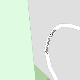
22 Westwood Mews
£ 470,000
Description
We don't have a Description for this property.
- Bedrooms
- 3
- Bathrooms
- 0

Leaflet © OpenStreetMap contributors
The heatmap indicates the level of crime in the area. The color of the heatmap indicates the crime severity and recency.
Metrics Year-on-Year
- Average area value
- 440,724.00 £Decreased by 8.73 %
- Average area rental value
- 1,861.00 £/moIncreased by 3.45 %
- Est rental Yield
- 5.07 %Increased by 13.42 %
- Crime Rate
- 1.00 %Unchanged by 0.00 %
from 482,862.00 £
from 1,799.00 £/mo
from 4.47 %
from 1.00 %
Nearby Schools
| Name | Type | Ofsted | Distance |
|---|---|---|---|
| Lytham Hall Park Primary School | Community School | Outstanding | 0.41 KM |
| Lytham Church Of England Voluntary Aided Primary School | Voluntary Aided School | Good | 1.43 KM |
| St Bede'S Catholic High School | Voluntary Aided School | Good | 1.86 KM |
| St Peter'S Catholic Primary School, Lytham | Voluntary Aided School | Good | 2.04 KM |
| Lytham Children'S Centre | Children's Centre Linked Site | 2.07 KM |
Images
Nearby Streets
| Name | Average Price | Average Sqft | Distance |
|---|---|---|---|
| The Grange | £ 0 | 0 | 0.00 KM |
| The Mariners | £ 0 | 0 | 0.00 KM |
| Bridge Road | £ 375,000 | 0 | 0.00 KM |
| The Sidings | £ 0 | 0 | 0.00 KM |
Nearby Transport
| Name | NLC | TLC | Distance |
|---|---|---|---|
| Lytham | 2670 | LTM | 0.74 KM |
| Ansdell And Fairhaven | 2662 | AFV | 2.53 KM |
| Moss Side | 2675 | MOS | 4.31 KM |
| St Annes-On-The-Sea | 2672 | SAS | 6.70 KM |
| Squires Gate | 2666 | SQU | 9.87 KM |
Nearby Listings
| Address | Price | Type | Score | Distance |
|---|---|---|---|---|
| Westwood Mews, Lytham | £ 465,000 | BUY | Unknown | 0.01 KM |
| Westwood Mews, Lytham, FY8 | £ 645,000 | BUY | 7 / 10 | 0.02 KM |
| Westwood Mews, Lytham, FY8 | £ 940,000 | BUY | 8 / 10 | 0.06 KM |
| Lowther Cottage, Church Road, Lytham | £ 549,950 | BUY | 6 / 10 | 0.07 KM |
| Westwood Mews, Lytham St. Annes | £ 825,000 | BUY | 8 / 10 | 0.07 KM |
Nearby Properties
| Address | Price | Distance |
|---|---|---|
| 25 Westwood Mews | £ 410,000 | 0.00 KM |
| 22 Westwood Mews | £ 470,000 | 0.00 KM |
| 11 Westwood Mews | £ 320,000 | 0.00 KM |
| 18 Westwood Mews | £ 455,000 | 0.00 KM |
| 12 Westwood Mews | £ 315,000 | 0.00 KM |