UN
4 Barnfield
£ 124,000
Description
We don't have a Description for this property.
- Bedrooms
- 2
- Bathrooms
- 0

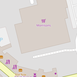

Leaflet © OpenStreetMap contributors
The heatmap indicates the level of crime in the area. The color of the heatmap indicates the crime severity and recency.
Metrics Year-on-Year
- Average area value
- 250,000.00 £Increased by 9.92 %
- Average area rental value
- 725.00 £/moDecreased by 43.49 %
- Est rental Yield
- 3.48 %Decreased by 48.60 %
- Crime Rate
- 37.00 %Unchanged by 0.00 %
from 227,435.00 £
from 1,283.00 £/mo
from 6.77 %
from 37.00 %
Nearby Schools
| Name | Type | Ofsted | Distance |
|---|---|---|---|
| Kirkham Pear Tree School | Community Special School | Outstanding | 0.10 KM |
| Pear Tree Children'S Centre | Children's Centre | 0.23 KM | |
| Kirkham And Wesham Primary School | Community School | Good | 0.63 KM |
| The Willows Catholic Primary School, Kirkham | Voluntary Aided School | Outstanding | 0.77 KM |
| Kirkham St Michael'S Church Of England Primary School | Voluntary Aided School | Good | 0.78 KM |
Images
Nearby Streets
| Name | Average Price | Average Sqft | Distance |
|---|---|---|---|
| Langton Road | £ 0 | 0 | 0.00 KM |
| Brooklands Avenue | £ 0 | 0 | 0.00 KM |
| Stanley Street | £ 0 | 0 | 0.00 KM |
| Chestnut Close | £ 155,000 | 0 | 0.00 KM |
| Stanley Court | £ 0 | 0 | 0.00 KM |
Nearby Transport
| Name | NLC | TLC | Distance |
|---|---|---|---|
| Kirkham And Wesham | 2668 | KKM | 0.79 KM |
| Salwick | 2673 | SLW | 6.63 KM |
| Moss Side | 2675 | MOS | 7.56 KM |
Nearby Listings
| Address | Price | Type | Score | Distance |
|---|---|---|---|---|
| 3 Langton Road, Kirkham, Preston, Lancashire, PR4 2AR | £ 100,000 | BUY | 5 / 10 | 0.04 KM |
| 1 Langton Road, Kirkham, Preston, Lancashire, PR4 2AR | £ 100,000 | BUY | 5 / 10 | 0.04 KM |
| 5 Langton Road, Kirkham, Preston, Lancashire, PR4 2AR | £ 100,000 | BUY | 5 / 10 | 0.05 KM |
| 7 Langton Road, Kirkham, Preston, Lancashire, PR4 2AR | £ 100,000 | BUY | 5 / 10 | 0.05 KM |
| Station Road, Kirkham, PR4 | £ 85,000 | BUY | Unknown | 0.09 KM |
Nearby Properties
| Address | Price | Distance |
|---|---|---|
| 23 Barnfield | £ 123,905 | 0.00 KM |
| 6 Barnfield | £ 76,500 | 0.00 KM |
| 4 Barnfield | £ 124,000 | 0.00 KM |
| Beauladene | £ 37,500 | 0.00 KM |
| 8 Barnfield | £ 113,000 | 0.00 KM |