UN
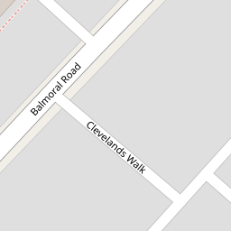
9 Brook Road
£ 105,000
Description
We don't have a Description for this property.
- Bedrooms
- 2
- Bathrooms
- 0

Leaflet © OpenStreetMap contributors
The heatmap indicates the level of crime in the area. The color of the heatmap indicates the crime severity and recency.
Metrics Year-on-Year
- Average area value
- 168,069.00 £Increased by 12.80 %
- Average area rental value
- 806.00 £/moDecreased by 21.90 %
- Est rental Yield
- 5.75 %Decreased by 30.81 %
- Crime Rate
- 6.00 %Unchanged by 0.00 %
from 148,997.00 £
from 1,032.00 £/mo
from 8.31 %
from 6.00 %
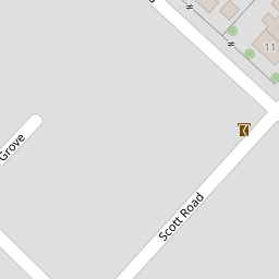
Nearby Schools
| Name | Type | Ofsted | Distance |
|---|---|---|---|
| Bay Leadership Academy | Academy Sponsor Led | 0.25 KM | |
| Balmoral Children'S Centre | Children's Centre | 0.26 KM | |
| West End Primary School | Community School | Good | 0.33 KM |
| Morecambe And Heysham Sandylands Community Primary School | Community School | Good | 0.70 KM |
| St Patrick'S Catholic Primary School | Voluntary Aided School | Good | 1.55 KM |
Images
Nearby Streets
| Name | Average Price | Average Sqft | Distance |
|---|---|---|---|
| Limes Avenue | £ 171,667 | 0 | 0.00 KM |
| Fox Grove | £ 0 | 0 | 0.00 KM |
| Clarendon Road | £ 139,975 | 0 | 0.00 KM |
| King's Crescent | £ 173,333 | 0 | 0.00 KM |
| Barnes Road | £ 215,000 | 0 | 0.00 KM |
Nearby Transport
| Name | NLC | TLC | Distance |
|---|---|---|---|
| Morecambe | 2695 | MCM | 1.30 KM |
| Bare Lane | 2690 | BAR | 4.85 KM |
| Heysham Port | 2691 | HHB | 5.08 KM |
| Lancaster | 2685 | LAN | 7.85 KM |
Nearby Listings
| Address | Price | Type | Score | Distance |
|---|---|---|---|---|
| Brook Road, Morecambe | £ 185,000 | BUY | 6 / 10 | 0.03 KM |
| Devonshire Road, Morecambe, Lancashire, LA3 | £ 200,000 | BUY | 5 / 10 | 0.11 KM |
| Regent Park Avenue, Morecambe | £ 219,950 | BUY | 6 / 10 | 0.12 KM |
| Regent Park Avenue, Morecambe, LA3 1AU | £ 210,000 | BUY | Unknown | 0.12 KM |
| Osborne Crescent, Morecambe, Lancashire, LA3 | £ 160,000 | BUY | 6 / 10 | 0.14 KM |
Nearby Properties
| Address | Price | Distance |
|---|---|---|
| 8 Brook Road | £ 107,000 | 0.00 KM |
| 11 Brook Road | £ 142,000 | 0.00 KM |
| 5 Brook Road | £ 54,950 | 0.00 KM |
| 9 Brook Road | £ 105,000 | 0.00 KM |
| 15 Brook Road | £ 131,500 | 0.00 KM |