UN
87 Stocks Road
£ 126,500
Description
We don't have a Description for this property.
- Bedrooms
- 3
- Bathrooms
- 0
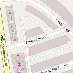


Leaflet © OpenStreetMap contributors
The heatmap indicates the level of crime in the area. The color of the heatmap indicates the crime severity and recency.
Metrics Year-on-Year
- Average area value
- 265,854.00 £Increased by 29.69 %
- Average area rental value
- 925.00 £/moIncreased by 13.92 %
- Est rental Yield
- 4.18 %Decreased by 12.00 %
- Crime Rate
- 10.00 %Unchanged by 0.00 %
from 204,990.00 £
from 812.00 £/mo
from 4.75 %
from 10.00 %
Nearby Schools
| Name | Type | Ofsted | Distance |
|---|---|---|---|
| Sacred Heart Catholic Primary School | Voluntary Aided School | Requires improvement | 0.69 KM |
| The Roebuck School | Community School | Requires improvement | 0.82 KM |
| St Anthony'S Catholic Primary School | Voluntary Aided School | Good | 0.95 KM |
| Our Lady'S Catholic High School | Voluntary Aided School | Outstanding | 1.09 KM |
| Ashton-On-Ribble St Andrew'S Church Of England Primary School | Voluntary Aided School | Outstanding | 1.12 KM |
Images
Nearby Streets
| Name | Average Price | Average Sqft | Distance |
|---|---|---|---|
| Banks Road | £ 0 | 0 | 0.00 KM |
| Austin Crescent | £ 170,000 | 0 | 0.00 KM |
| Hastings Road | £ 280,000 | 0 | 0.00 KM |
| Coniston Avenue | £ 160,000 | 0 | 0.00 KM |
| Mayfield Road | £ 155,000 | 0 | 0.00 KM |
Nearby Transport
| Name | NLC | TLC | Distance |
|---|---|---|---|
| Preston (Lancs) | 2753 | PRE | 2.78 KM |
| Lostock Hall | 2689 | LOH | 6.96 KM |
| Bamber Bridge | 2561 | BMB | 8.98 KM |
| Leyland | 2710 | LEY | 9.31 KM |
| Salwick | 2673 | SLW | 9.89 KM |
Nearby Listings
| Address | Price | Type | Score | Distance |
|---|---|---|---|---|
| Belmont Road, Ashton, Preston | £ 104,950 | BUY | 5 / 10 | 0.04 KM |
| Ord Road, Ashton-On-Ribble, PR2 | £ 139,950 | BUY | 7 / 10 | 0.18 KM |
| Lytham Road, Ashton, Preston | £ 235,000 | BUY | 6 / 10 | 0.20 KM |
| Lytham Road, Ashton on Ribble, Preston, PR2 | £ 240,000 | BUY | 6 / 10 | 0.21 KM |
| Tulketh Brow, Ashton-On-Ribble, Preston, PR2 | £ 100,000 | BUY | 3 / 10 | 0.21 KM |
Nearby Properties
| Address | Price | Distance |
|---|---|---|
| 87 Stocks Road | £ 126,500 | 0.00 KM |
| 73 Stocks Road | £ 119,000 | 0.00 KM |
| 81 Stocks Road | £ 70,000 | 0.00 KM |
| 75 Stocks Road | £ 105,950 | 0.00 KM |
| 79 Stocks Road | £ 116,250 | 0.00 KM |