UN
57 Burrow Road
£ 120,000
Description
We don't have a Description for this property.
- Bedrooms
- 3
- Bathrooms
- 0
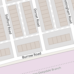

Leaflet © OpenStreetMap contributors
The heatmap indicates the level of crime in the area. The color of the heatmap indicates the crime severity and recency.
Metrics Year-on-Year
- Average area value
- 45,000.00 £Decreased by 65.05 %
- Average area rental value
- 833.00 £/moIncreased by 14.27 %
- Est rental Yield
- 22.21 %Increased by 227.10 %
- Crime Rate
- 4.00 %Unchanged by 0.00 %
from 128,748.00 £
from 729.00 £/mo
from 6.79 %
from 4.00 %
Nearby Schools
| Name | Type | Ofsted | Distance |
|---|---|---|---|
| St Ignatius' Catholic Primary School | Voluntary Aided School | Requires improvement | 0.43 KM |
| Moor Park High School And Sixth Form | Foundation School | Good | 0.49 KM |
| Deepdale Community Primary School | Community School | Requires improvement | 0.60 KM |
| Acorns Primary School | Community Special School | Good | 0.81 KM |
| Preston Muslim Girls High School | Voluntary Aided School | Outstanding | 0.84 KM |
Images
Nearby Streets
| Name | Average Price | Average Sqft | Distance |
|---|---|---|---|
| Stanleyfield Close | £ 0 | 0 | 0.00 KM |
| Essex Street | £ 0 | 0 | 0.00 KM |
| Penny Street | £ 0 | 0 | 0.00 KM |
| Meadow Street | £ 0 | 0 | 0.00 KM |
| Carlisle Street | £ 0 | 0 | 0.00 KM |
Nearby Transport
| Name | NLC | TLC | Distance |
|---|---|---|---|
| Preston (Lancs) | 2753 | PRE | 1.92 KM |
| Lostock Hall | 2689 | LOH | 4.79 KM |
| Bamber Bridge | 2561 | BMB | 5.77 KM |
| Leyland | 2710 | LEY | 7.60 KM |
Nearby Listings
| Address | Price | Type | Score | Distance |
|---|---|---|---|---|
| Dorset Road, Preston, Lancashire, PR1 | £ 110,000 | BUY | Unknown | 0.07 KM |
| Deepdale Road, Preston, PR1 | £ 225,000 | BUY | 6 / 10 | 0.23 KM |
| St. Cuthberts Road, Preston | £ 150,000 | BUY | 5 / 10 | 0.23 KM |
| St Pauls Road, Preston | £ 240,000 | BUY | Unknown | 0.31 KM |
| St. Christophers Road, Preston, PR1 | £ 115,000 | BUY | 5 / 10 | 0.35 KM |
Nearby Properties
| Address | Price | Distance |
|---|---|---|
| 57 Burrow Road | £ 120,000 | 0.00 KM |
| 15 Burrow Road | £ 155,000 | 0.00 KM |
| 17 Burrow Road | £ 92,500 | 0.00 KM |
| 47 Burrow Road | £ 120,000 | 0.00 KM |
| 33 Burrow Road | £ 35,000 | 0.00 KM |