UN
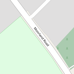
50 Moorland Road
£ 445,000
Description
We don't have a Description for this property.
- Bedrooms
- 5
- Bathrooms
- 0

Leaflet © OpenStreetMap contributors
The heatmap indicates the level of crime in the area. The color of the heatmap indicates the crime severity and recency.
Metrics Year-on-Year
- Average area value
- 215,183.00 £Decreased by 30.95 %
- Average area rental value
- 884.00 £/moIncreased by 2.55 %
- Est rental Yield
- 4.93 %Increased by 48.49 %
- Crime Rate
- 15.00 %Unchanged by 0.00 %
from 311,620.00 £
from 862.00 £/mo
from 3.32 %
from 15.00 %
Nearby Schools
| Name | Type | Ofsted | Distance |
|---|---|---|---|
| Hodgson Academy | Academy Converter | 0.30 KM | |
| St John'S Catholic Primary School, Poulton-Le-Fylde | Voluntary Aided School | Outstanding | 0.43 KM |
| Brookfield School | Community Special School | Good | 0.53 KM |
| Poulton-Le-Fylde The Breck Primary School | Community School | Outstanding | 0.56 KM |
| Mckee College House | Pupil Referral Unit | Good | 0.73 KM |
Images
Nearby Streets
| Name | Average Price | Average Sqft | Distance |
|---|---|---|---|
| Manor Drive | £ 95,000 | 0 | 0.00 KM |
| Farriers Way | £ 0 | 0 | 0.00 KM |
| Hardhorn Road | £ 0 | 0 | 0.00 KM |
| Amethyst Drive | £ 0 | 0 | 0.00 KM |
| Elm Close | £ 0 | 0 | 0.00 KM |
Nearby Transport
| Name | NLC | TLC | Distance |
|---|---|---|---|
| Poulton-Le-Fylde | 2671 | PFY | 0.82 KM |
| Layton (Lancs) | 2669 | LAY | 5.40 KM |
| Blackpool North | 2739 | BPN | 7.91 KM |
| Blackpool South | 2740 | BPS | 9.20 KM |
Nearby Listings
| Address | Price | Type | Score | Distance |
|---|---|---|---|---|
| Moorland Road, Poulton-le-Fylde | £ 599,950 | BUY | Unknown | 0.00 KM |
| No. 11, The Spinney, Poulton-le-Fylde, Lancs FY6 7EZ | £ 399,950 | BUY | Unknown | 0.09 KM |
| Moorway, Poulton-le-Fylde | £ 295,000 | BUY | 7 / 10 | 0.12 KM |
| Taywood Close, Poulton Le Fylde | £ 179,995 | BUY | 6 / 10 | 0.18 KM |
| No. 19, Moorway, Poulton-le-Fylde, Lancs FY6 7EX | £ 225,000 | BUY | 6 / 10 | 0.20 KM |
Nearby Properties
| Address | Price | Distance |
|---|---|---|
| 36 Moorland Road | £ 347,000 | 0.00 KM |
| 65 Moorland Road | £ 262,000 | 0.00 KM |
| 48 Moorland Road | £ 385,000 | 0.00 KM |
| 102 Moorland Road | £ 298,000 | 0.00 KM |
| 50 Moorland Road | £ 445,000 | 0.00 KM |