UN
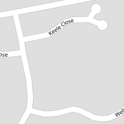
2 Keele Close
£ 200,000
Description
We don't have a Description for this property.
- Bedrooms
- 4
- Bathrooms
- 0


Leaflet © OpenStreetMap contributors
The heatmap indicates the level of crime in the area. The color of the heatmap indicates the crime severity and recency.
Metrics Year-on-Year
- Average area value
- 194,181.00 £Decreased by 8.20 %
- Average area rental value
- 775.00 £/moDecreased by 1.65 %
- Est rental Yield
- 4.79 %Increased by 7.16 %
- Crime Rate
- 5.00 %Unchanged by 0.00 %
from 211,525.00 £
from 788.00 £/mo
from 4.47 %
from 5.00 %
Nearby Schools
| Name | Type | Ofsted | Distance |
|---|---|---|---|
| Thornton Cleveleys Royles Brook Primary School | Community School | Good | 0.17 KM |
| Sacred Heart Catholic Primary School, Thornton Cleveleys | Voluntary Aided School | Good | 1.05 KM |
| Great Arley School | Community Special School | Good | 1.28 KM |
| Thornton-Cleveleys Red Marsh School | Community Special School | Outstanding | 1.37 KM |
| Thornton Primary School | Community School | Good | 1.48 KM |
Images
Nearby Streets
| Name | Average Price | Average Sqft | Distance |
|---|---|---|---|
| Millfield Court | £ 0 | 0 | 0.00 KM |
| Calder Avenue | £ 0 | 0 | 0.00 KM |
| Tudor Close | £ 0 | 0 | 0.00 KM |
| The Chase | £ 0 | 0 | 0.00 KM |
| Grassington Place | £ 0 | 0 | 0.00 KM |
Nearby Transport
| Name | NLC | TLC | Distance |
|---|---|---|---|
| Poulton-Le-Fylde | 2671 | PFY | 4.32 KM |
| Layton (Lancs) | 2669 | LAY | 4.78 KM |
| Blackpool North | 2739 | BPN | 7.00 KM |
| Blackpool South | 2740 | BPS | 9.31 KM |
Nearby Listings
| Address | Price | Type | Score | Distance |
|---|---|---|---|---|
| Church Road, Thornton-Cleveleys, FY5 | £ 190,000 | BUY | 5 / 10 | 0.11 KM |
| Keats Close, Thornton, FY5 | £ 330,000 | BUY | 7 / 10 | 0.18 KM |
| Keats Close, Thornton, FY5 | £ 230,000 | BUY | 7 / 10 | 0.20 KM |
| Marsh Road, Thornton-Cleveleys, FY5 | £ 210,000 | BUY | 7 / 10 | 0.24 KM |
| Wordsworth Avenue, Thornton-Cleveleys, FY5 | £ 240,000 | BUY | 6 / 10 | 0.29 KM |
Nearby Properties
| Address | Price | Distance |
|---|---|---|
| 2 Keele Close | £ 200,000 | 0.00 KM |
| 3 Keele Close | £ 230,000 | 0.00 KM |
| 11 Wells Close | £ 160,000 | 0.08 KM |
| 17 Wells Close | £ 215,000 | 0.08 KM |
| 9 Wells Close | £ 357,500 | 0.08 KM |