UN
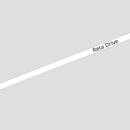
7 Reta Drive
£ 128,000
Description
We don't have a Description for this property.
- Bedrooms
- 3
- Bathrooms
- 0


Leaflet © OpenStreetMap contributors
The heatmap indicates the level of crime in the area. The color of the heatmap indicates the crime severity and recency.
Metrics Year-on-Year
- Average area value
- 194,181.00 £Decreased by 8.20 %
- Average area rental value
- 775.00 £/moDecreased by 1.65 %
- Est rental Yield
- 4.79 %Increased by 7.16 %
- Crime Rate
- 14.00 %Unchanged by 0.00 %
from 211,525.00 £
from 788.00 £/mo
from 4.47 %
from 14.00 %
Nearby Schools
| Name | Type | Ofsted | Distance |
|---|---|---|---|
| Sacred Heart Catholic Primary School, Thornton Cleveleys | Voluntary Aided School | Good | 0.51 KM |
| Thornton Cleveleys Royles Brook Primary School | Community School | Good | 0.67 KM |
| Great Arley School | Community Special School | Good | 0.80 KM |
| Thornton-Cleveleys Red Marsh School | Community Special School | Outstanding | 0.86 KM |
| Thornton Primary School | Community School | Good | 0.88 KM |
Images
Nearby Streets
| Name | Average Price | Average Sqft | Distance |
|---|---|---|---|
| The Chase | £ 0 | 0 | 0.00 KM |
| Burrstone Grange | £ 170,000 | 0 | 0.00 KM |
| Cherry Lane | £ 270,000 | 0 | 0.00 KM |
| Millfield Court | £ 0 | 0 | 0.00 KM |
| Butts Road | £ 347,475 | 0 | 0.00 KM |
Nearby Transport
| Name | NLC | TLC | Distance |
|---|---|---|---|
| Poulton-Le-Fylde | 2671 | PFY | 4.60 KM |
| Layton (Lancs) | 2669 | LAY | 5.56 KM |
| Blackpool North | 2739 | BPN | 7.81 KM |
Nearby Listings
| Address | Price | Type | Score | Distance |
|---|---|---|---|---|
| Taywood Road, Thornton, FY5 | £ 180,000 | BUY | 6 / 10 | 0.08 KM |
| West Drive, Thornton-Cleveleys, Lancashire, FY5 | £ 159,950 | BUY | 5 / 10 | 0.14 KM |
| West Drive, Thornton-Cleveleys | £ 230,000 | BUY | 7 / 10 | 0.14 KM |
| FAIRHOLMES WAY - THORNTON CLEVELEYS - FY5 2SJ | £ 200,000 | BUY | 7 / 10 | 0.16 KM |
| West Drive, Thornton, FY5 | £ 179,950 | BUY | 6 / 10 | 0.16 KM |
Nearby Properties
| Address | Price | Distance |
|---|---|---|
| 14 Reta Drive | £ 122,500 | 0.00 KM |
| 12 Reta Drive | £ 123,500 | 0.00 KM |
| 6 Reta Drive | £ 121,900 | 0.00 KM |
| 7 Reta Drive | £ 128,000 | 0.00 KM |
| 4 Reta Drive | £ 120,000 | 0.00 KM |