UN
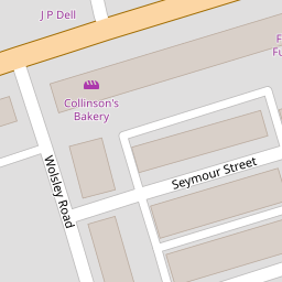
8 Seymour Street
£ 65,500
Description
We don't have a Description for this property.
- Bedrooms
- 3
- Bathrooms
- 0

Leaflet © OpenStreetMap contributors
The heatmap indicates the level of crime in the area. The color of the heatmap indicates the crime severity and recency.
Metrics Year-on-Year
- Average area value
- 156,815.00 £Increased by 19.92 %
- Average area rental value
- 725.00 £/moIncreased by 8.05 %
- Est rental Yield
- 5.55 %Decreased by 9.90 %
- Crime Rate
- 12.00 %Unchanged by 0.00 %
from 130,767.00 £
from 671.00 £/mo
from 6.16 %
from 12.00 %
Nearby Schools
| Name | Type | Ofsted | Distance |
|---|---|---|---|
| Fleetwood Chaucer Community Primary School | Community School | Requires improvement | 0.52 KM |
| Shakespeare Primary School | Community School | Outstanding | 0.79 KM |
| St Mary'S Catholic Primary School, Fleetwood | Voluntary Aided School | Good | 1.09 KM |
| St Wulstan'S And St Edmund'S Catholic Primary School And Nursery | Voluntary Aided School | Requires improvement | 1.12 KM |
| Sure Start Fleetwood Children'S Centre | Children's Centre | 1.41 KM |
Images
Nearby Streets
| Name | Average Price | Average Sqft | Distance |
|---|---|---|---|
| Deepdale Road | £ 84,950 | 0 | 0.00 KM |
| Darbishire Road | £ 350,000 | 0 | 0.00 KM |
| Greenway | £ 0 | 0 | 0.00 KM |
| Little Wood | £ 64,950 | 0 | 0.00 KM |
| Manor Road | £ 0 | 0 | 0.00 KM |
Nearby Transport
| Name | NLC | TLC | Distance |
|---|---|---|---|
| Poulton-Le-Fylde | 2671 | PFY | 8.73 KM |
| Layton (Lancs) | 2669 | LAY | 9.46 KM |
Nearby Listings
| Address | Price | Type | Score | Distance |
|---|---|---|---|---|
| Seymour Street, Fleetwood, Lancashire, FY7 | £ 53,000 | BUY | 4 / 10 | 0.07 KM |
| Albany Road, Fleetwood, Lancashire, FY7 | £ 49,500 | BUY | 4 / 10 | 0.07 KM |
| Memorial Park, Fleetwood, FY7 | £ 125,000 | BUY | 6 / 10 | 0.10 KM |
| Percy Street, Fleetwood, Lancashire, FY7 | £ 115,000 | BUY | Unknown | 0.10 KM |
| Memorial Park, Fleetwood, FY7 | £ 136,000 | BUY | Unknown | 0.10 KM |
Nearby Properties
| Address | Price | Distance |
|---|---|---|
| 4 Seymour Street | £ 65,000 | 0.00 KM |
| 12 Seymour Street | £ 66,500 | 0.00 KM |
| 15 Seymour Street | £ 64,000 | 0.00 KM |
| 22 Seymour Street | £ 65,500 | 0.00 KM |
| 8 Seymour Street | £ 65,500 | 0.00 KM |