UN
6 The Oaks
£ 157,500
Description
We don't have a Description for this property.
- Bedrooms
- 3
- Bathrooms
- 0
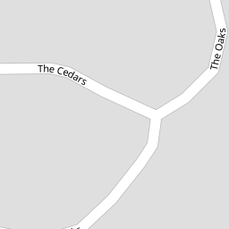


Leaflet © OpenStreetMap contributors
The heatmap indicates the level of crime in the area. The color of the heatmap indicates the crime severity and recency.
Metrics Year-on-Year
- Average area value
- 128,931.00 £Decreased by 26.80 %
- Average area rental value
- 838.00 £/moDecreased by 4.23 %
- Est rental Yield
- 7.80 %Increased by 30.87 %
- Crime Rate
- 9.00 %Unchanged by 0.00 %
from 176,126.00 £
from 875.00 £/mo
from 5.96 %
from 9.00 %
Nearby Schools
| Name | Type | Ofsted | Distance |
|---|---|---|---|
| Emmaus Church Of England And Catholic Primary School | Voluntary Aided School | Outstanding | 0.49 KM |
| Croxteth Community Primary School | Academy Sponsor Led | 1.55 KM | |
| St Albert'S Catholic Primary School | Voluntary Aided School | Good | 1.78 KM |
| Mab Lane Junior Mixed And Infant School | Community School | Good | 2.04 KM |
| Bluebell Park School | Community Special School | Good | 2.19 KM |
Images
Nearby Streets
| Name | Average Price | Average Sqft | Distance |
|---|---|---|---|
| Saint Cuthbert's Close | £ 0 | 0 | 0.00 KM |
| The Pines | £ 326,667 | 0 | 0.00 KM |
| Gelling's Lane | £ 2,500,000 | 0 | 0.00 KM |
| Helford Road | £ 0 | 0 | 0.00 KM |
| Hare Croft | £ 110,000 | 0 | 0.00 KM |
Nearby Transport
| Name | NLC | TLC | Distance |
|---|---|---|---|
| Kirkby (Merseyside) | 2124 | KIR | 4.48 KM |
| Broad Green | 2240 | BGE | 5.28 KM |
| Roby | 2261 | ROB | 5.45 KM |
| Huyton | 2160 | HUY | 6.32 KM |
| Fazakerley | 2126 | FAZ | 6.45 KM |
Nearby Listings
| Address | Price | Type | Score | Distance |
|---|---|---|---|---|
| Woodvale Road, West Derby, Croxteth Park, Liverpool | £ 193,950 | BUY | 7 / 10 | 0.10 KM |
| Woodvale Road, West Derby, Liverpool, Merseyside, L12 | £ 185,000 | BUY | Unknown | 0.12 KM |
| Woodvale Road, West Derby, Country Park, Liverpool, L12 | £ 200,000 | BUY | Unknown | 0.12 KM |
| Sherwood Court, West Derby, Liverpool, L12 | £ 169,950 | BUY | Unknown | 0.20 KM |
| Abbotsbury Way, Liverpool, L12 | £ 190,000 | BUY | 7 / 10 | 0.22 KM |
Nearby Properties
| Address | Price | Distance |
|---|---|---|
| 6 The Oaks | £ 157,500 | 0.00 KM |
| 9 The Oaks | £ 110,000 | 0.00 KM |
| 11 The Cedars | £ 138,000 | 0.07 KM |
| 12 The Cedars | £ 44,000 | 0.07 KM |
| 15 Woodvale Road | £ 200,000 | 0.12 KM |