UN
6 Mill Lane
£ 365,000
Description
We don't have a Description for this property.
- Bedrooms
- 6
- Bathrooms
- 0

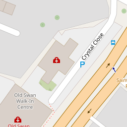

Leaflet © OpenStreetMap contributors
The heatmap indicates the level of crime in the area. The color of the heatmap indicates the crime severity and recency.
Metrics Year-on-Year
- Average area value
- 148,537.00 £Increased by 5.33 %
- Average area rental value
- 832.00 £/moIncreased by 13.66 %
- Est rental Yield
- 6.72 %Increased by 7.87 %
- Crime Rate
- 8.00 %Unchanged by 0.00 %
from 141,023.00 £
from 732.00 £/mo
from 6.23 %
from 8.00 %
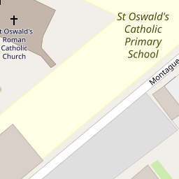
Nearby Schools
| Name | Type | Ofsted | Distance |
|---|---|---|---|
| St Oswald'S Catholic Primary School | Voluntary Aided School | Good | 0.09 KM |
| Broadgreen Primary | Foundation School | Good | 0.66 KM |
| St Anne'S (Stanley) Junior Mixed And Infant School | Voluntary Aided School | Good | 0.67 KM |
| Northway Primary And Nursery School | Community School | Good | 0.99 KM |
| Corinthian Community Primary School | Community School | Good | 1.05 KM |
Images
Nearby Streets
| Name | Average Price | Average Sqft | Distance |
|---|---|---|---|
| Montague Road | £ 170,000 | 0 | 0.00 KM |
| Cunningham Road | £ 174,975 | 0 | 0.00 KM |
| Rock Street | £ 0 | 0 | 0.00 KM |
| Davidson Road | £ 157,500 | 0 | 0.00 KM |
| Charlton Road | £ 150,000 | 0 | 0.00 KM |
Nearby Transport
| Name | NLC | TLC | Distance |
|---|---|---|---|
| Wavertree Technology Park | 8589 | WAV | 1.09 KM |
| Broad Green | 2240 | BGE | 2.40 KM |
| Mossley Hill | 2171 | MSH | 3.53 KM |
| Edge Hill | 2169 | EDG | 3.62 KM |
| West Allerton | 2266 | WSA | 4.71 KM |
Nearby Listings
| Address | Price | Type | Score | Distance |
|---|---|---|---|---|
| Mill Lane, Old Swan, Liverpool, Merseyside, L13 | £ 125,000 | BUY | 5 / 10 | 0.01 KM |
| St. Oswalds Street, Liverpool, Merseyside, L13 | £ 175,000 | BUY | Unknown | 0.12 KM |
| St. Oswalds Street, Liverpool, Merseyside, L13 | £ 180,500 | BUY | Unknown | 0.12 KM |
| Pemberton Road, Liverpool | £ 140,000 | BUY | 5 / 10 | 0.38 KM |
| Allenby Square, Old Swan, Liverpool | £ 165,000 | BUY | 5 / 10 | 0.39 KM |
Nearby Properties
| Address | Price | Distance |
|---|---|---|
| 36 Mill Lane | £ 150,000 | 0.00 KM |
| 42 Mill Lane | £ 145,000 | 0.00 KM |
| 40 Mill Lane | £ 118,000 | 0.00 KM |
| 6 Mill Lane | £ 365,000 | 0.00 KM |
| 32 Mill Lane | £ 50,000 | 0.02 KM |