UN
6 Westway
£ 182,000
Description
We don't have a Description for this property.
- Bedrooms
- 3
- Bathrooms
- 0
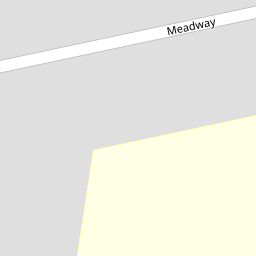


Leaflet © OpenStreetMap contributors
The heatmap indicates the level of crime in the area. The color of the heatmap indicates the crime severity and recency.
Metrics Year-on-Year
- Average area value
- 205,058.00 £Decreased by 16.69 %
- Average area rental value
- 915.00 £/moDecreased by 1.40 %
- Est rental Yield
- 5.35 %Increased by 18.36 %
- Crime Rate
- 1.00 %Unchanged by 0.00 %
from 246,143.00 £
from 928.00 £/mo
from 4.52 %
from 1.00 %
Nearby Schools
| Name | Type | Ofsted | Distance |
|---|---|---|---|
| Christ The King Catholic Primary School | Voluntary Aided School | Good | 0.33 KM |
| King David Primary School | Voluntary Aided School | Good | 0.47 KM |
| Childwall Sports & Science Academy | Academy Sponsor Led | Requires improvement | 0.52 KM |
| King David High School | Voluntary Aided School | Outstanding | 0.58 KM |
| Northway Primary And Nursery School | Community School | Good | 0.72 KM |
Images
Nearby Streets
| Name | Average Price | Average Sqft | Distance |
|---|---|---|---|
| Westway | £ 317,500 | 0 | 0.00 KM |
| Fieldway | £ 322,500 | 0 | 0.00 KM |
| Southway | £ 336,000 | 0 | 0.00 KM |
| Meadway | £ 277,500 | 0 | 0.00 KM |
| Heywood Court | £ 96,667 | 0 | 0.00 KM |
Nearby Transport
| Name | NLC | TLC | Distance |
|---|---|---|---|
| Broad Green | 2240 | BGE | 1.41 KM |
| Wavertree Technology Park | 8589 | WAV | 2.17 KM |
| Mossley Hill | 2171 | MSH | 2.61 KM |
| West Allerton | 2266 | WSA | 3.40 KM |
| Cressington | 2225 | CSG | 4.63 KM |
Nearby Listings
| Address | Price | Type | Score | Distance |
|---|---|---|---|---|
| Wavertree Nook Road, Liverpool. | £ 300,000 | BUY | 8 / 10 | 0.08 KM |
| Thingwall Road, Wavertree, L15 | £ 325,000 | BUY | 7 / 10 | 0.16 KM |
| Abbeystead Road, Liverpool, Merseyside, L15 | £ 325,000 | BUY | 7 / 10 | 0.27 KM |
| Wavertree Nook Road, Wavertree Gardens, Liverpool, L15 | £ 425,000 | BUY | Unknown | 0.31 KM |
| Nook Rise, Wavertree Gardens, Liverpool, L15 | £ 290,000 | BUY | 7 / 10 | 0.33 KM |
Nearby Properties
| Address | Price | Distance |
|---|---|---|
| 6 Westway | £ 182,000 | 0.00 KM |
| 20 Westway | £ 159,000 | 0.00 KM |
| 8 Westway | £ 140,000 | 0.00 KM |
| 40 Westway | £ 132,500 | 0.00 KM |
| 27 Westway | £ 220,000 | 0.01 KM |