UN
58 Dovercroft
£ 77,500
Description
We don't have a Description for this property.
- Bedrooms
- 2
- Bathrooms
- 0
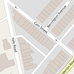

Leaflet © OpenStreetMap contributors
The heatmap indicates the level of crime in the area. The color of the heatmap indicates the crime severity and recency.
Metrics Year-on-Year
- Average area value
- 399,369.00 £Decreased by 3.66 %
- Average area rental value
- 1,324.00 £/moIncreased by 10.06 %
- Est rental Yield
- 3.98 %Increased by 14.37 %
- Crime Rate
- 10.00 %Unchanged by 0.00 %
from 414,526.00 £
from 1,203.00 £/mo
from 3.48 %
from 10.00 %
Nearby Schools
| Name | Type | Ofsted | Distance |
|---|---|---|---|
| Bishop Martin Church Of England Primary School, Woolton | Academy Converter | 0.57 KM | |
| St Julie'S Catholic High School | Voluntary Aided School | Good | 1.08 KM |
| Abbot'S Lea School | Community Special School | Outstanding | 1.19 KM |
| St Francis Xavier'S College | Academy Converter | Requires improvement | 1.20 KM |
| Woolton High School | Community Special School | Good | 1.20 KM |
Images
Nearby Streets
| Name | Average Price | Average Sqft | Distance |
|---|---|---|---|
| Vale Road | £ 201,000 | 0 | 0.00 KM |
| Castle Street | £ 296,111 | 0 | 0.00 KM |
| Cobden Place | £ 215,000 | 0 | 0.00 KM |
| Pitt Place | £ 0 | 0 | 0.00 KM |
| Poplar Road | £ 382,500 | 0 | 0.00 KM |
Nearby Transport
| Name | NLC | TLC | Distance |
|---|---|---|---|
| Liverpool South Parkway | 9709 | LPY | 2.29 KM |
| Hunts Cross | 2235 | HNX | 2.55 KM |
| West Allerton | 2266 | WSA | 3.52 KM |
| Broad Green | 2240 | BGE | 4.23 KM |
| Cressington | 2225 | CSG | 4.36 KM |
Nearby Listings
| Address | Price | Type | Score | Distance |
|---|---|---|---|---|
| Dovercroft, Woolton, L25 | £ 95,000 | BUY | 6 / 10 | 0.01 KM |
| Reynolds Court, Woolton | £ 132,500 | BUY | Unknown | 0.06 KM |
| Cheddar Close, Woolton, L25 | £ 89,950 | BUY | Unknown | 0.08 KM |
| Vale Road, Woolton, Liverpool, Merseyside, L25 | £ 190,000 | BUY | 5 / 10 | 0.09 KM |
| Vale Road, Woolton, Liverpool, Merseyside, L25 | £ 149,995 | BUY | 5 / 10 | 0.09 KM |
Nearby Properties
| Address | Price | Distance |
|---|---|---|
| 73 Dovercroft | £ 89,000 | 0.00 KM |
| 76 Dovercroft | £ 95,000 | 0.00 KM |
| 58 Dovercroft | £ 77,500 | 0.00 KM |
| 55 Dovercroft | £ 120,000 | 0.00 KM |
| 186 Vale Road | £ 142,000 | 0.09 KM |