UN
1 Covertside Road
£ 82,000
Description
We don't have a Description for this property.
- Bedrooms
- 4
- Bathrooms
- 0

Leaflet © OpenStreetMap contributors
The heatmap indicates the level of crime in the area. The color of the heatmap indicates the crime severity and recency.
Metrics Year-on-Year
- Average area value
- 350,455.00 £Increased by 5.50 %
- Average area rental value
- 10,875.00 £/moIncreased by 953.78 %
- Est rental Yield
- 37.24 %Increased by 898.39 %
- Crime Rate
- 15.00 %Unchanged by 0.00 %
from 332,171.00 £
from 1,032.00 £/mo
from 3.73 %
from 15.00 %
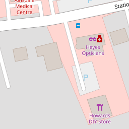
Nearby Schools
| Name | Type | Ofsted | Distance |
|---|---|---|---|
| Ainsdale St John'S Church Of England Primary School | Voluntary Aided School | Outstanding | 0.71 KM |
| Kings Meadow Primary School And Early Years Education Centre | Community School | Good | 1.07 KM |
| Kings Meadow Children'S Centre | Children's Centre Linked Site | 1.07 KM | |
| Merefield School | Community Special School | Outstanding | 1.18 KM |
| Shoreside Primary School | Academy Sponsor Led | 1.57 KM |
Images
Nearby Streets
| Name | Average Price | Average Sqft | Distance |
|---|---|---|---|
| Greenford Road | £ 0 | 0 | 0.00 KM |
| Wentworth Close | £ 339,499 | 0 | 0.00 KM |
| Briar Road | £ 245,000 | 0 | 0.00 KM |
| Carlton Road | £ 590,000 | 0 | 0.00 KM |
| Sandbrook Grove | £ 0 | 0 | 0.00 KM |
Nearby Transport
| Name | NLC | TLC | Distance |
|---|---|---|---|
| Ainsdale | 2350 | ANS | 0.48 KM |
| Hillside | 2231 | HIL | 2.79 KM |
| Birkdale | 2352 | BDL | 4.53 KM |
| Freshfield | 2355 | FRE | 5.37 KM |
| Formby | 2354 | FBY | 6.39 KM |
Nearby Listings
| Address | Price | Type | Score | Distance |
|---|---|---|---|---|
| The Woodlands, Southport, Merseyside, PR8 | £ 89,950 | BUY | 6 / 10 | 0.00 KM |
| The Woodlands, Southport, Merseyside, PR8 | £ 130,000 | BUY | 7 / 10 | 0.00 KM |
| The Woodlands, Ainsdale, Southport, PR8 3LN | £ 87,500 | BUY | 6 / 10 | 0.02 KM |
| The Woodlands, Southport | £ 125,000 | BUY | 7 / 10 | 0.02 KM |
| Station Road, Ainsdale, Southport, Merseyside, PR8 | £ 95,000 | BUY | 6 / 10 | 0.12 KM |
Nearby Properties
| Address | Price | Distance |
|---|---|---|
| 11 The Woodlands | £ 92,500 | 0.00 KM |
| 28 The Woodlands | £ 108,500 | 0.00 KM |
| 29 The Woodlands | £ 85,750 | 0.00 KM |
| 1 Covertside Road | £ 82,000 | 0.00 KM |
| 16 The Woodlands | £ 105,000 | 0.00 KM |