UN
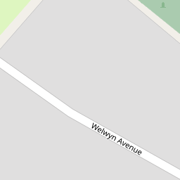
5 Welwyn Avenue
£ 225,000
Description
We don't have a Description for this property.
- Bedrooms
- 3
- Bathrooms
- 0


Leaflet © OpenStreetMap contributors
The heatmap indicates the level of crime in the area. The color of the heatmap indicates the crime severity and recency.
Metrics Year-on-Year
- Average area value
- 350,455.00 £Increased by 5.50 %
- Average area rental value
- 10,875.00 £/moIncreased by 953.78 %
- Est rental Yield
- 37.24 %Increased by 898.39 %
- Crime Rate
- 1.00 %Unchanged by 0.00 %
from 332,171.00 £
from 1,032.00 £/mo
from 3.73 %
from 1.00 %
Nearby Schools
| Name | Type | Ofsted | Distance |
|---|---|---|---|
| Birkdale High School | Academy Converter | Good | 0.70 KM |
| Ainsdale St John'S Church Of England Primary School | Voluntary Aided School | Outstanding | 0.97 KM |
| Greenbank High School | Academy Converter | 1.66 KM | |
| Farnborough Road First Steps Children'S Centre | Children's Centre | 1.75 KM | |
| Farnborough Road Junior School | Community School | Good | 1.92 KM |
Images
Nearby Streets
| Name | Average Price | Average Sqft | Distance |
|---|---|---|---|
| Charles Avenue | £ 0 | 0 | 0.00 KM |
| Segar's Lane | £ 308,750 | 0 | 0.00 KM |
| Sandbrook Grove | £ 0 | 0 | 0.00 KM |
| Briar Road | £ 245,000 | 0 | 0.00 KM |
| Carlton Road | £ 590,000 | 0 | 0.00 KM |
Nearby Transport
| Name | NLC | TLC | Distance |
|---|---|---|---|
| Hillside | 2231 | HIL | 1.67 KM |
| Ainsdale | 2350 | ANS | 1.67 KM |
| Birkdale | 2352 | BDL | 3.33 KM |
| Southport | 2262 | SOP | 5.20 KM |
| Freshfield | 2355 | FRE | 6.65 KM |
Nearby Listings
| Address | Price | Type | Score | Distance |
|---|---|---|---|---|
| Welwyn Avenue, Southport, PR8 3BE | £ 500,000 | BUY | Unknown | 0.08 KM |
| Liverpool Road, Southport | £ 360,000 | BUY | 6 / 10 | 0.16 KM |
| Liverpool Road, Ainsdale, Southport, PR8 | £ 600,000 | BUY | 7 / 10 | 0.19 KM |
| Liverpool Road, Ainsdale, Southport, PR8 | £ 600,000 | BUY | 8 / 10 | 0.19 KM |
| St. Thomas More Drive, Southport | £ 340,000 | BUY | Unknown | 0.38 KM |
Nearby Properties
| Address | Price | Distance |
|---|---|---|
| 7 Welwyn Avenue | £ 190,000 | 0.00 KM |
| 4 Welwyn Avenue | £ 117,250 | 0.00 KM |
| 5 Welwyn Avenue | £ 225,000 | 0.00 KM |
| 21 Welwyn Avenue | £ 275,000 | 0.00 KM |
| 1 Welwyn Avenue | £ 218,500 | 0.06 KM |