UN
55 Dunbar Road
£ 205,000
Description
We don't have a Description for this property.
- Bedrooms
- 3
- Bathrooms
- 0


Leaflet © OpenStreetMap contributors
The heatmap indicates the level of crime in the area. The color of the heatmap indicates the crime severity and recency.
Metrics Year-on-Year
- Average area value
- 307,499.00 £Increased by 5.42 %
- Average area rental value
- 999.00 £/moIncreased by 5.94 %
- Est rental Yield
- 3.90 %Increased by 0.52 %
- Crime Rate
- 3.00 %Unchanged by 0.00 %
from 291,693.00 £
from 943.00 £/mo
from 3.88 %
from 3.00 %
Nearby Schools
| Name | Type | Ofsted | Distance |
|---|---|---|---|
| Greenbank High School | Academy Converter | 0.68 KM | |
| Farnborough Road First Steps Children'S Centre | Children's Centre | 0.93 KM | |
| Farnborough Road Junior School | Community School | Good | 1.12 KM |
| Farnborough Road Infant School | Community School | Good | 1.12 KM |
| Birkdale High School | Academy Converter | Good | 1.14 KM |
Images
Nearby Streets
| Name | Average Price | Average Sqft | Distance |
|---|---|---|---|
| Harrod Drive | £ 650,000 | 0 | 0.00 KM |
| Greenbank Drive | £ 0 | 0 | 0.00 KM |
| Grosvenor Gardens | £ 625,000 | 0 | 0.00 KM |
| Belgrave Place | £ 629,999 | 0 | 0.00 KM |
| Shaftesbury Grove | £ 0 | 0 | 0.00 KM |
Nearby Transport
| Name | NLC | TLC | Distance |
|---|---|---|---|
| Hillside | 2231 | HIL | 0.35 KM |
| Birkdale | 2352 | BDL | 1.56 KM |
| Ainsdale | 2350 | ANS | 3.22 KM |
| Southport | 2262 | SOP | 3.45 KM |
| Meols Cop | 2357 | MEC | 5.73 KM |
Nearby Listings
| Address | Price | Type | Score | Distance |
|---|---|---|---|---|
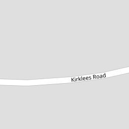
| Kirklees Road, Hillside, Southport, PR8 | £ 275,000 | BUY | 5 / 10 | 0.22 KM |
| Dover Road, Southport | £ 500,000 | BUY | 8 / 10 | 0.24 KM |
| Sandon Road, Birkdale, Southport | £ 320,000 | BUY | 7 / 10 | 0.26 KM |
| Hillside Road, Birkdale, Southport, Merseyside, PR8 4QB | £ 435,000 | BUY | Unknown | 0.26 KM |
| Kirklees Road, Southport | £ 325,000 | BUY | 8 / 10 | 0.27 KM |
Nearby Properties
| Address | Price | Distance |
|---|---|---|
| 27 Dunbar Road | £ 285,000 | 0.00 KM |
| 39 Dunbar Road | £ 295,000 | 0.00 KM |
| 55 Dunbar Road | £ 205,000 | 0.00 KM |
| 40 Dunbar Road | £ 244,995 | 0.00 KM |
| 29 Dunbar Road | £ 237,500 | 0.00 KM |