UN
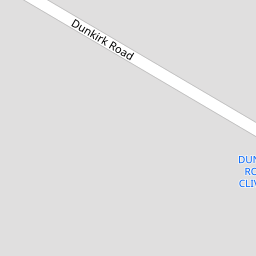
2 Dunkirk Road
£ 335,000
Description
We don't have a Description for this property.
- Bedrooms
- 4
- Bathrooms
- 0


Leaflet © OpenStreetMap contributors
The heatmap indicates the level of crime in the area. The color of the heatmap indicates the crime severity and recency.
Metrics Year-on-Year
- Average area value
- 307,499.00 £Increased by 5.42 %
- Average area rental value
- 999.00 £/moIncreased by 5.94 %
- Est rental Yield
- 3.90 %Increased by 0.52 %
- Crime Rate
- 2.00 %Unchanged by 0.00 %
from 291,693.00 £
from 943.00 £/mo
from 3.88 %
from 2.00 %
Nearby Schools
| Name | Type | Ofsted | Distance |
|---|---|---|---|
| Our Lady Of Lourdes Catholic Primary School | Voluntary Aided School | Good | 0.88 KM |
| Farnborough Road First Steps Children'S Centre | Children's Centre | 0.90 KM | |
| Farnborough Road Infant School | Community School | Good | 1.02 KM |
| Farnborough Road Junior School | Community School | Good | 1.02 KM |
| Greenbank High School | Academy Converter | 1.07 KM |
Images
Nearby Streets
| Name | Average Price | Average Sqft | Distance |
|---|---|---|---|
| Harrod Drive | £ 650,000 | 0 | 0.00 KM |
| Grosvenor Gardens | £ 625,000 | 0 | 0.00 KM |
| Belgrave Place | £ 629,999 | 0 | 0.00 KM |
| College Close | £ 0 | 0 | 0.00 KM |
| Shaftesbury Grove | £ 0 | 0 | 0.00 KM |
Nearby Transport
| Name | NLC | TLC | Distance |
|---|---|---|---|
| Hillside | 2231 | HIL | 0.76 KM |
| Birkdale | 2352 | BDL | 1.20 KM |
| Southport | 2262 | SOP | 3.06 KM |
| Ainsdale | 2350 | ANS | 3.64 KM |
| Meols Cop | 2357 | MEC | 5.30 KM |
Nearby Listings
| Address | Price | Type | Score | Distance |
|---|---|---|---|---|
| Dunkirk Road Hillside Birkdale Southport PR8 4QZ | £ 475,000 | BUY | 8 / 10 | 0.01 KM |
| Dunkirk Road, Southport, PR8 | £ 300,000 | BUY | Unknown | 0.07 KM |
| Clive Road Birkdale PR8 4RZ | £ 400,000 | BUY | 6 / 10 | 0.12 KM |
| Clive Road, Birkdale, Southport, Merseyside, PR8 4RZ | £ 345,000 | BUY | 8 / 10 | 0.17 KM |
| Hartley Road, Birkdale, Southport, Merseyside, PR8 4RY | £ 399,950 | BUY | 8 / 10 | 0.18 KM |
Nearby Properties
| Address | Price | Distance |
|---|---|---|
| 2 Dunkirk Road | £ 335,000 | 0.00 KM |
| 16 Dunkirk Road | £ 281,500 | 0.00 KM |
| 29 Dunkirk Road | £ 254,000 | 0.00 KM |
| 33 Dunkirk Road | £ 172,000 | 0.00 KM |
| 8 Dunkirk Road | £ 355,000 | 0.00 KM |