UN
16 Hornby Road
£ 164,500
Description
We don't have a Description for this property.
- Bedrooms
- 2
- Bathrooms
- 0
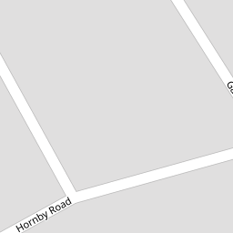

Leaflet © OpenStreetMap contributors
The heatmap indicates the level of crime in the area. The color of the heatmap indicates the crime severity and recency.
Metrics Year-on-Year
- Average area value
- 213,571.00 £Decreased by 10.43 %
- Average area rental value
- 998.00 £/moIncreased by 48.07 %
- Est rental Yield
- 5.61 %Increased by 65.49 %
- Crime Rate
- 2.00 %Unchanged by 0.00 %
from 238,437.00 £
from 674.00 £/mo
from 3.39 %
from 2.00 %
Nearby Schools
| Name | Type | Ofsted | Distance |
|---|---|---|---|
| Marshside Primary School | Community School | Requires improvement | 0.37 KM |
| Peterhouse School | Non-maintained Special School | Outstanding | 0.73 KM |
| Presfield High School And Specialist College | Community Special School | Good | 0.75 KM |
| Crossens Nursery School | Local Authority Nursery School | Outstanding | 0.80 KM |
| Larkfield Primary School | Community School | Good | 0.82 KM |
Images
Nearby Streets
| Name | Average Price | Average Sqft | Distance |
|---|---|---|---|
| Manx Janes Lane | £ 0 | 0 | 0.00 KM |
| Churchgate Mews | £ 0 | 0 | 0.00 KM |
| Beresford Drive | £ 295,000 | 0 | 0.00 KM |
| Montrose Drive | £ 276,590 | 0 | 0.00 KM |
| Carisbrooke Drive | £ 0 | 0 | 0.00 KM |
Nearby Transport
| Name | NLC | TLC | Distance |
|---|---|---|---|
| Meols Cop | 2357 | MEC | 2.94 KM |
| Southport | 2262 | SOP | 4.76 KM |
| Birkdale | 2352 | BDL | 6.66 KM |
| Lytham | 2670 | LTM | 7.57 KM |
| Bescar Lane | 2351 | BES | 7.86 KM |
Nearby Listings
| Address | Price | Type | Score | Distance |
|---|---|---|---|---|
| Garstang Road, Southport, Merseyside, PR9 | £ 230,000 | BUY | Unknown | 0.12 KM |
| Garstang Road, Marshside, Southport | £ 280,000 | BUY | 7 / 10 | 0.15 KM |
| Garstang Road, Marshside, Southport | £ 240,000 | BUY | Unknown | 0.15 KM |
| Fylde Road, Southport, Merseyside, PR9 | £ 180,000 | BUY | 6 / 10 | 0.19 KM |
| Totnes Drive, Southport | £ 190,000 | BUY | 6 / 10 | 0.24 KM |
Nearby Properties
| Address | Price | Distance |
|---|---|---|
| 37 Hornby Road | £ 172,500 | 0.00 KM |
| 39 Hornby Road | £ 143,000 | 0.00 KM |
| 19 Hornby Road | £ 159,000 | 0.00 KM |
| 4 Hornby Road | £ 155,000 | 0.00 KM |
| 16 Hornby Road | £ 164,500 | 0.00 KM |