UN
86 Park Road
£ 410,000
Description
We don't have a Description for this property.
- Bedrooms
- 6
- Bathrooms
- 0
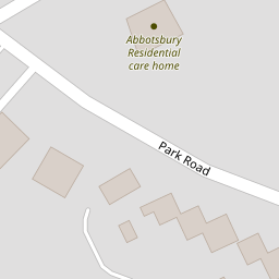

Leaflet © OpenStreetMap contributors
The heatmap indicates the level of crime in the area. The color of the heatmap indicates the crime severity and recency.
Metrics Year-on-Year
- Average area value
- 309,176.00 £Increased by 24.54 %
- Average area rental value
- 879.00 £/moIncreased by 13.42 %
- Est rental Yield
- 3.41 %Decreased by 9.07 %
- Crime Rate
- 7.00 %Unchanged by 0.00 %
from 248,246.00 £
from 775.00 £/mo
from 3.75 %
from 7.00 %
Nearby Schools
| Name | Type | Ofsted | Distance |
|---|---|---|---|
| Holy Family Catholic Primary School | Voluntary Aided School | Good | 0.66 KM |
| Norwood Primary School | Community School | Good | 0.74 KM |
| Holy Trinity Church Of England Primary School, Southport | Academy Converter | 1.27 KM | |
| Arden College | Special Post 16 Institution | Good | 1.30 KM |
| St Philip'S Church Of England Primary School | Voluntary Aided School | Good | 1.31 KM |
Images
Nearby Streets
| Name | Average Price | Average Sqft | Distance |
|---|---|---|---|
| Manchester Road | £ 177,000 | 0 | 0.00 KM |
| Willow Grove | £ 0 | 0 | 0.00 KM |
| Tithebarn Road | £ 120,000 | 0 | 0.00 KM |
| Darwin Court | £ 0 | 0 | 0.00 KM |
| Pilkington Road | £ 280,000 | 0 | 0.00 KM |
Nearby Transport
| Name | NLC | TLC | Distance |
|---|---|---|---|
| Meols Cop | 2357 | MEC | 1.20 KM |
| Southport | 2262 | SOP | 1.97 KM |
| Birkdale | 2352 | BDL | 3.75 KM |
| Hillside | 2231 | HIL | 5.44 KM |
| Ainsdale | 2350 | ANS | 8.38 KM |
Nearby Listings
| Address | Price | Type | Score | Distance |
|---|---|---|---|---|
| Park Court, Southport, Merseyside, PR9 | £ 125,000 | BUY | Unknown | 0.03 KM |
| Park Road, Southport, Merseyside, PR9 | £ 125,000 | BUY | 6 / 10 | 0.06 KM |
| Roe Lane, Southport | £ 425,000 | BUY | 6 / 10 | 0.09 KM |
| Park Road, Southport | £ 115,000 | BUY | 5 / 10 | 0.14 KM |
| Roe Lane, SOUTHPORT, Merseyside, PR9 | £ 450,000 | BUY | 6 / 10 | 0.17 KM |
Nearby Properties
| Address | Price | Distance |
|---|---|---|
| 86 Park Road | £ 410,000 | 0.00 KM |
| 7 Roe Park Mews | £ 220,000 | 0.09 KM |
| 6 Roe Park Mews | £ 235,000 | 0.09 KM |
| 11 Park Road | £ 295,000 | 0.14 KM |
| 3 Woodlands Close | £ 345,000 | 0.17 KM |