UN
8 Melling Road
£ 100,000
Description
We don't have a Description for this property.
- Bedrooms
- 3
- Bathrooms
- 0
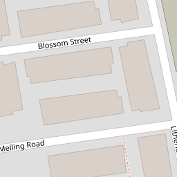


Leaflet © OpenStreetMap contributors
The heatmap indicates the level of crime in the area. The color of the heatmap indicates the crime severity and recency.
Metrics Year-on-Year
- Average area value
- 219,135.00 £Increased by 22.32 %
- Average area rental value
- 738.00 £/moIncreased by 26.15 %
- Est rental Yield
- 4.04 %Increased by 3.06 %
- Crime Rate
- 12.00 %Unchanged by 0.00 %
from 179,142.00 £
from 585.00 £/mo
from 3.92 %
from 12.00 %
Nearby Schools
| Name | Type | Ofsted | Distance |
|---|---|---|---|
| Linacre Primary School | Community School | Requires improvement | 0.27 KM |
| Christ Church Church Of England Controlled Primary School | Voluntary Controlled School | Good | 0.72 KM |
| Greenacre Community Nursery School | Local Authority Nursery School | Good | 0.73 KM |
| Lander Road Primary School | Community School | Good | 0.75 KM |
| All Saints Catholic Primary School | Voluntary Aided School | Good | 0.76 KM |
Images
Nearby Streets
| Name | Average Price | Average Sqft | Distance |
|---|---|---|---|
| Oak Street | £ 0 | 0 | 0.00 KM |
| Jersey Street | £ 47,475 | 0 | 0.00 KM |
| Litherland Road | £ 0 | 0 | 0.00 KM |
| Essex Way | £ 0 | 0 | 0.00 KM |
| Waterworks Street | £ 185,000 | 0 | 0.00 KM |
Nearby Transport
| Name | NLC | TLC | Distance |
|---|---|---|---|
| Bootle New Strand | 2195 | BNW | 0.62 KM |
| Bootle Oriel Road | 2239 | BOT | 1.29 KM |
| Seaforth And Litherland | 2250 | SFL | 1.97 KM |
| Kirkdale | 2245 | KKD | 2.07 KM |
| Bank Hall | 2238 | BAH | 2.19 KM |
Nearby Listings
| Address | Price | Type | Score | Distance |
|---|---|---|---|---|
| Blossom Street, Bootle | £ 110,000 | BUY | Unknown | 0.06 KM |
| 110 Thornton Road, Bootle L20 5AS | £ 80,000 | BUY | 4 / 10 | 0.12 KM |
| 110 THORNTON ROAD, BOOTLE, MERSEYSIDE | £ 75,000 | BUY | 4 / 10 | 0.12 KM |
| Thornton Road, Bootle, L20 | £ 110,000 | BUY | Unknown | 0.12 KM |
| Stanley Road, Bootle | £ 54,950 | BUY | 7 / 10 | 0.14 KM |
Nearby Properties
| Address | Price | Distance |
|---|---|---|
| 8 Melling Road | £ 100,000 | 0.00 KM |
| 7 Melling Road | £ 83,000 | 0.00 KM |
| 15 Melling Road | £ 22,000 | 0.00 KM |
| 20 Melling Road | £ 84,000 | 0.00 KM |
| 16 Blossom Street | £ 80,000 | 0.05 KM |