UN
2 Ince Avenue
£ 29,000
Description
We don't have a Description for this property.
- Bedrooms
- 3
- Bathrooms
- 0
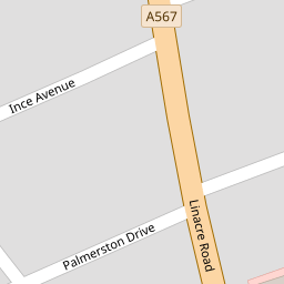

Leaflet © OpenStreetMap contributors
The heatmap indicates the level of crime in the area. The color of the heatmap indicates the crime severity and recency.
Metrics Year-on-Year
- Average area value
- 123,750.00 £Decreased by 33.18 %
- Average area rental value
- 768.00 £/moDecreased by 3.15 %
- Est rental Yield
- 7.45 %Increased by 44.94 %
- Crime Rate
- 11.00 %Unchanged by 0.00 %
from 185,189.00 £
from 793.00 £/mo
from 5.14 %
from 11.00 %
Nearby Schools
| Name | Type | Ofsted | Distance |
|---|---|---|---|
| Our Lady Star Of The Sea Catholic Primary School | Voluntary Aided School | Good | 0.56 KM |
| English Martyrs' Catholic Primary School | Voluntary Aided School | Good | 0.79 KM |
| Lander Road Primary School | Community School | Good | 0.84 KM |
| St Elizabeth'S Catholic Primary School | Voluntary Aided School | Good | 0.88 KM |
| Rimrose Hope Cofe Primary School | Voluntary Controlled School | Good | 0.97 KM |
Images
Nearby Streets
| Name | Average Price | Average Sqft | Distance |
|---|---|---|---|
| Snowdrop Mews | £ 0 | 0 | 0.00 KM |
| Wood Street | £ 145,000 | 0 | 0.00 KM |
| Oxford Avenue | £ 0 | 0 | 0.00 KM |
| Selsey Road | £ 0 | 0 | 0.00 KM |
| School Lane | £ 0 | 0 | 0.00 KM |
Nearby Transport
| Name | NLC | TLC | Distance |
|---|---|---|---|
| Seaforth And Litherland | 2250 | SFL | 0.54 KM |
| Bootle New Strand | 2195 | BNW | 1.61 KM |
| Bootle Oriel Road | 2239 | BOT | 2.28 KM |
| Waterloo (Merseyside) | 2133 | WLO | 2.89 KM |
| Bank Hall | 2238 | BAH | 3.55 KM |
Nearby Listings
| Address | Price | Type | Score | Distance |
|---|---|---|---|---|
| Palmerston Drive, Liverpool | £ 129,950 | BUY | 7 / 10 | 0.07 KM |
| 47 Eaton Avenue, Seaforth, Liverpool, L21 6NG | £ 120,000 | BUY | Unknown | 0.11 KM |
| Sefton Avenue, Liverpool, L21 | £ 140,000 | BUY | 6 / 10 | 0.11 KM |
| Penrhyn Avenue, Litherland, Merseyside, L21 | £ 139,950 | BUY | 5 / 10 | 0.12 KM |
| Sefton Avenue, Seaforth, Liverpool | £ 100,000 | BUY | 5 / 10 | 0.12 KM |
Nearby Properties
| Address | Price | Distance |
|---|---|---|
| 21 Ince Avenue | £ 60,000 | 0.00 KM |
| 4 Ince Avenue | £ 50,000 | 0.00 KM |
| 2 Ince Avenue | £ 29,000 | 0.00 KM |
| 19 Ince Avenue | £ 54,000 | 0.00 KM |
| 17 Ince Avenue | £ 90,000 | 0.00 KM |