UN
5 Lily Road
£ 61,000
Description
We don't have a Description for this property.
- Bedrooms
- 3
- Bathrooms
- 0
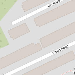

Leaflet © OpenStreetMap contributors
The heatmap indicates the level of crime in the area. The color of the heatmap indicates the crime severity and recency.
Metrics Year-on-Year
- Average area value
- 207,988.00 £Increased by 43.60 %
- Average area rental value
- 804.00 £/moIncreased by 16.86 %
- Est rental Yield
- 4.64 %Decreased by 18.60 %
- Crime Rate
- 9.00 %Unchanged by 0.00 %
from 144,838.00 £
from 688.00 £/mo
from 5.70 %
from 9.00 %
Nearby Schools
| Name | Type | Ofsted | Distance |
|---|---|---|---|
| Our Lady Star Of The Sea Catholic Primary School | Voluntary Aided School | Good | 0.58 KM |
| Lander Road Primary School | Community School | Good | 0.63 KM |
| St Elizabeth'S Catholic Primary School | Voluntary Aided School | Good | 0.71 KM |
| Thomas Gray Primary School | Community School | Requires improvement | 0.81 KM |
| English Martyrs' Catholic Primary School | Voluntary Aided School | Good | 0.95 KM |
Images
Nearby Streets
| Name | Average Price | Average Sqft | Distance |
|---|---|---|---|
| Wood Street | £ 145,000 | 0 | 0.00 KM |
| Chesnut Grove | £ 164,950 | 0 | 0.00 KM |
| New Fort Way | £ 0 | 0 | 0.00 KM |
| Selsey Road | £ 0 | 0 | 0.00 KM |
| Oxford Avenue | £ 0 | 0 | 0.00 KM |
Nearby Transport
| Name | NLC | TLC | Distance |
|---|---|---|---|
| Seaforth And Litherland | 2250 | SFL | 0.69 KM |
| Bootle New Strand | 2195 | BNW | 1.32 KM |
| Bootle Oriel Road | 2239 | BOT | 2.00 KM |
| Waterloo (Merseyside) | 2133 | WLO | 3.09 KM |
| Bank Hall | 2238 | BAH | 3.26 KM |
Nearby Listings
| Address | Price | Type | Score | Distance |
|---|---|---|---|---|
| Violet Road, Liverpool, Merseyside, L21 6NZ | £ 85,000 | BUY | 4 / 10 | 0.06 KM |
| Linacre Road, Liverpool, L21 | £ 60,000 | BUY | 4 / 10 | 0.10 KM |
| May Close, Liverpool, L21 | £ 66,000 | BUY | 5 / 10 | 0.12 KM |
| Longfield Road, Litherland, Liverpool, L21 | £ 85,000 | BUY | Unknown | 0.17 KM |
| Hapsford Rd, Liverpool, Merseyside | £ 140,000 | BUY | 7 / 10 | 0.17 KM |
Nearby Properties
| Address | Price | Distance |
|---|---|---|
| 5 Lily Road | £ 61,000 | 0.00 KM |
| 10 Lily Road | £ 85,000 | 0.00 KM |
| 21 Lily Road | £ 29,500 | 0.00 KM |
| 18 Lily Road | £ 63,000 | 0.00 KM |
| 39 Lily Road | £ 66,150 | 0.00 KM |