UN
11 Barncroft Place
£ 45,000
Description
We don't have a Description for this property.
- Bedrooms
- 4
- Bathrooms
- 0
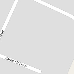


Leaflet © OpenStreetMap contributors
The heatmap indicates the level of crime in the area. The color of the heatmap indicates the crime severity and recency.
Metrics Year-on-Year
- Average area value
- 387,843.00 £Increased by 1.47 %
- Average area rental value
- 1,806.00 £/moIncreased by 16.22 %
- Est rental Yield
- 5.59 %Increased by 14.55 %
- Crime Rate
- 11.00 %Unchanged by 0.00 %
from 382,238.00 £
from 1,554.00 £/mo
from 4.88 %
from 11.00 %
Nearby Schools
| Name | Type | Ofsted | Distance |
|---|---|---|---|
| St Luke'S Halsall Church Of England Primary School | Voluntary Aided School | Good | 0.53 KM |
| Crosby High School | Community Special School | Good | 0.55 KM |
| Sacred Heart Catholic College | Voluntary Aided School | Requires improvement | 0.79 KM |
| Merchant Taylors' Girls' School | Other Independent School | 0.85 KM | |
| Valewood Primary School | Community School | Good | 0.93 KM |
Images
Nearby Streets
| Name | Average Price | Average Sqft | Distance |
|---|---|---|---|
| Mayfair Avenue | £ 0 | 0 | 0.00 KM |
| Moor Lane | £ 0 | 0 | 0.00 KM |
| Sycamore Avenue | £ 0 | 0 | 0.00 KM |
| Wembley Road | £ 0 | 0 | 0.00 KM |
| Highfield Grove | £ 0 | 0 | 0.00 KM |
Nearby Transport
| Name | NLC | TLC | Distance |
|---|---|---|---|
| Blundellsands And Crosby | 2123 | BLN | 1.98 KM |
| Waterloo (Merseyside) | 2133 | WLO | 2.48 KM |
| Hall Road | 2229 | HLR | 2.75 KM |
| Seaforth And Litherland | 2250 | SFL | 4.04 KM |
| Hightown | 2356 | HTO | 4.73 KM |
Nearby Listings
| Address | Price | Type | Score | Distance |
|---|---|---|---|---|
| Oaklands Avenue, Liverpool, Merseyside, L23 | £ 265,000 | BUY | 8 / 10 | 0.08 KM |
| Woodend Avenue, Crosby, Liverpool | £ 135,000 | BUY | 7 / 10 | 0.15 KM |
| Mayfair Avenue, Crosby, L23 | £ 340,000 | BUY | 6 / 10 | 0.24 KM |
| Mayfair Avenue, Crosby, Liverpool | £ 360,000 | BUY | 7 / 10 | 0.27 KM |
| De Villiers Avenue, Liverpool | £ 425,000 | BUY | 7 / 10 | 0.30 KM |
Nearby Properties
| Address | Price | Distance |
|---|---|---|
| 11 Barncroft Place | £ 45,000 | 0.00 KM |
| 14 Barncroft Place | £ 160,000 | 0.00 KM |
| 9 Barncroft Place | £ 142,000 | 0.00 KM |
| 10 Barncroft Place | £ 145,000 | 0.00 KM |
| 67 Woodend Avenue | £ 130,000 | 0.05 KM |