UN
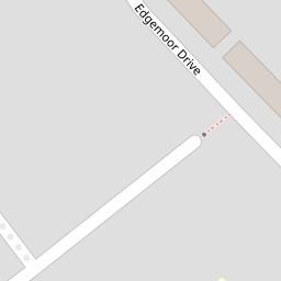
132 Edgemoor Drive
£ 140,000
Description
We don't have a Description for this property.
- Bedrooms
- 3
- Bathrooms
- 0


Leaflet © OpenStreetMap contributors
The heatmap indicates the level of crime in the area. The color of the heatmap indicates the crime severity and recency.
Metrics Year-on-Year
- Average area value
- 387,843.00 £Increased by 1.47 %
- Average area rental value
- 1,806.00 £/moIncreased by 16.22 %
- Est rental Yield
- 5.59 %Increased by 14.55 %
- Crime Rate
- 9.00 %Unchanged by 0.00 %
from 382,238.00 £
from 1,554.00 £/mo
from 4.88 %
from 9.00 %
Nearby Schools
| Name | Type | Ofsted | Distance |
|---|---|---|---|
| Chesterfield High School | Academy Converter | Good | 0.30 KM |
| St William Of York Catholic Primary School | Voluntary Aided School | Good | 0.32 KM |
| Thornton Children'S Centre | Children's Centre Linked Site | 0.52 KM | |
| Jigsaw Primary Pupil Referral Unit | Pupil Referral Unit | Good | 0.55 KM |
| Newfield School | Community Special School | Good | 0.60 KM |
Images
Nearby Streets
| Name | Average Price | Average Sqft | Distance |
|---|---|---|---|
| White Meadow Drive | £ 180,000 | 0 | 0.00 KM |
| Drummond Road | £ 166,000 | 0 | 0.00 KM |
| Lavender Gardens | £ 0 | 0 | 0.00 KM |
| Moorlands Road | £ 200,000 | 0 | 0.00 KM |
| Holgate | £ 0 | 0 | 0.00 KM |
Nearby Transport
| Name | NLC | TLC | Distance |
|---|---|---|---|
| Seaforth And Litherland | 2250 | SFL | 3.08 KM |
| Waterloo (Merseyside) | 2133 | WLO | 3.22 KM |
| Blundellsands And Crosby | 2123 | BLN | 4.08 KM |
| Bootle New Strand | 2195 | BNW | 4.61 KM |
| Hall Road | 2229 | HLR | 5.11 KM |
Nearby Listings
| Address | Price | Type | Score | Distance |
|---|---|---|---|---|
| Edgemoor Drive, Thornton, Liverpool, Merseyside. L23 | £ 350,000 | BUY | 7 / 10 | 0.01 KM |
| Edgemoor Drive, Crosby, Liverpool | £ 200,000 | BUY | 7 / 10 | 0.10 KM |
| Fern Hey, Liverpool | £ 180,000 | BUY | 7 / 10 | 0.20 KM |
| Gorsefield Avenue, Crosby, Liverpool, L23 | £ 280,000 | BUY | Unknown | 0.22 KM |
| Cranfield Road, Crosby, Liverpool | £ 350,000 | BUY | 7 / 10 | 0.26 KM |
Nearby Properties
| Address | Price | Distance |
|---|---|---|
| 132 Edgemoor Drive | £ 140,000 | 0.00 KM |
| 116 Edgemoor Drive | £ 154,950 | 0.00 KM |
| 80 Edgemoor Drive | £ 130,000 | 0.00 KM |
| 66 Edgemoor Drive | £ 177,000 | 0.00 KM |
| 70 Edgemoor Drive | £ 148,000 | 0.00 KM |