UN
4 Baytree Grove
£ 198,000
Description
We don't have a Description for this property.
- Bedrooms
- 4
- Bathrooms
- 0
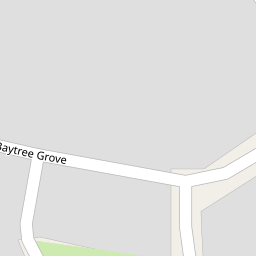

Leaflet © OpenStreetMap contributors
The heatmap indicates the level of crime in the area. The color of the heatmap indicates the crime severity and recency.
Metrics Year-on-Year
- Average area value
- 274,669.00 £Increased by 13.44 %
- Average area rental value
- 979.00 £/moDecreased by 16.82 %
- Est rental Yield
- 4.28 %Decreased by 26.59 %
- Crime Rate
- 7.00 %Unchanged by 0.00 %
from 242,118.00 £
from 1,177.00 £/mo
from 5.83 %
from 7.00 %
Nearby Schools
| Name | Type | Ofsted | Distance |
|---|---|---|---|
| Melling Primary School | Community School | Good | 0.84 KM |
| Westvale Primary School | Community School | Good | 1.30 KM |
| Eden Sscc | Children's Centre | 1.30 KM | |
| St Michael And All Angels Catholic Primary School | Voluntary Aided School | Outstanding | 1.97 KM |
| Holy Rosary Catholic Primary School | Voluntary Aided School | Outstanding | 2.18 KM |
Images
Nearby Streets
| Name | Average Price | Average Sqft | Distance |
|---|---|---|---|
| M57 | £ 0 | 0 | 0.00 KM |
| Mount Road | £ 144,995 | 0 | 0.00 KM |
| Foxbridge Road | £ 0 | 0 | 0.00 KM |
| Lognor Road | £ 140,000 | 0 | 0.00 KM |
| Canterbury Close | £ 285,000 | 0 | 0.00 KM |
Nearby Transport
| Name | NLC | TLC | Distance |
|---|---|---|---|
| Kirkby (Merseyside) | 2124 | KIR | 1.57 KM |
| Maghull | 2155 | MAG | 2.55 KM |
| Fazakerley | 2126 | FAZ | 3.06 KM |
| Maghull North | 6576 | MNS | 3.20 KM |
| Old Roan | 2258 | ORN | 3.78 KM |
Nearby Listings
| Address | Price | Type | Score | Distance |
|---|---|---|---|---|
| Baytree Grove, Liverpool, L31 | £ 330,000 | BUY | 7 / 10 | 0.01 KM |
| Dapple Heath Avenue, Melling, Liverpool | £ 145,000 | BUY | 6 / 10 | 0.15 KM |
| Dapple Heath Avenue, Melling | £ 129,950 | BUY | Unknown | 0.19 KM |
| Dapple Heath Avenue, Liverpool | £ 129,995 | BUY | 5 / 10 | 0.20 KM |
| Birchtree Drive, Melling, Liverpool, Merseyside, L31 | £ 370,000 | BUY | 7 / 10 | 0.22 KM |
Nearby Properties
| Address | Price | Distance |
|---|---|---|
| 37 Baytree Grove | £ 282,000 | 0.00 KM |
| 26 Baytree Grove | £ 215,000 | 0.00 KM |
| 16 Baytree Grove | £ 253,500 | 0.00 KM |
| 4 Baytree Grove | £ 198,000 | 0.00 KM |
| 31 Baytree Grove | £ 210,000 | 0.00 KM |