UN
9 Lancing Drive
£ 135,000
Description
We don't have a Description for this property.
- Bedrooms
- 2
- Bathrooms
- 0


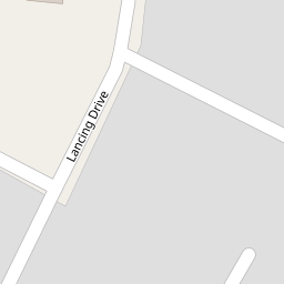

Leaflet © OpenStreetMap contributors
The heatmap indicates the level of crime in the area. The color of the heatmap indicates the crime severity and recency.
Metrics Year-on-Year
- Average area value
- 274,669.00 £Increased by 13.44 %
- Average area rental value
- 979.00 £/moDecreased by 16.82 %
- Est rental Yield
- 4.28 %Decreased by 26.59 %
- Crime Rate
- 4.00 %Unchanged by 0.00 %
from 242,118.00 £
from 1,177.00 £/mo
from 5.83 %
from 4.00 %
Nearby Schools
| Name | Type | Ofsted | Distance |
|---|---|---|---|
| Holy Rosary Catholic Primary School | Voluntary Aided School | Outstanding | 0.49 KM |
| Aintree Davenhill Primary School | Community School | Good | 0.60 KM |
| Fazakerley & Croxteth Children'S Centre | Children's Centre | 1.17 KM | |
| Barlows Primary School | Community School | Good | 1.39 KM |
| Dixons Fazakerley Academy | Academy Sponsor Led | 1.69 KM |
Images
Nearby Streets
| Name | Average Price | Average Sqft | Distance |
|---|---|---|---|
| Bleasdale Avenue | £ 135,000 | 0 | 0.00 KM |
| Canterbury Close | £ 285,000 | 0 | 0.00 KM |
| Cranwell Close | £ 240,000 | 0 | 0.00 KM |
| Barlow's Lane | £ 221,500 | 0 | 0.00 KM |
| Foxhunter Drive | £ 125,000 | 0 | 0.00 KM |
Nearby Transport
| Name | NLC | TLC | Distance |
|---|---|---|---|
| Fazakerley | 2126 | FAZ | 1.33 KM |
| Old Roan | 2258 | ORN | 1.71 KM |
| Aintree | 2125 | AIN | 2.30 KM |
| Maghull | 2155 | MAG | 2.90 KM |
| Orrell Park | 2247 | OPK | 3.63 KM |
Nearby Listings
| Address | Price | Type | Score | Distance |
|---|---|---|---|---|
| Lancing Drive, Liverpool, L10 8LW | £ 255,000 | BUY | Unknown | 0.08 KM |
| School Lane, Aintree Village, Liverpool | £ 220,000 | BUY | 7 / 10 | 0.27 KM |
| School Lane, Liverpool, Merseyside, L10 | £ 290,000 | BUY | 6 / 10 | 0.27 KM |
| Altway, Aintree Village, Liverpool | £ 299,950 | BUY | 5 / 10 | 0.28 KM |
| Wrekin Drive, Aintree Village, Liverpool | £ 190,000 | BUY | 5 / 10 | 0.34 KM |
Nearby Properties
| Address | Price | Distance |
|---|---|---|
| 9 Lancing Drive | £ 135,000 | 0.00 KM |
| 11 Lancing Drive | £ 70,000 | 0.00 KM |
| 28 Lancing Drive | £ 260,000 | 0.07 KM |
| 6 Lancing Drive | £ 182,000 | 0.07 KM |
| 4 Lancing Drive | £ 257,000 | 0.07 KM |