UN
41 Hereford Road
£ 210,000
Description
We don't have a Description for this property.
- Bedrooms
- 4
- Bathrooms
- 0


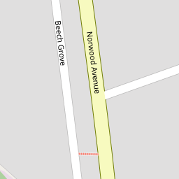

Leaflet © OpenStreetMap contributors
The heatmap indicates the level of crime in the area. The color of the heatmap indicates the crime severity and recency.
Metrics Year-on-Year
- Average area value
- 273,000.00 £Increased by 27.13 %
- Average area rental value
- 938.00 £/moDecreased by 8.75 %
- Est rental Yield
- 4.12 %Decreased by 28.22 %
- Crime Rate
- 7.00 %Unchanged by 0.00 %
from 214,740.00 £
from 1,028.00 £/mo
from 5.74 %
from 7.00 %
Nearby Schools
| Name | Type | Ofsted | Distance |
|---|---|---|---|
| Norwood Primary School | Community School | Good | 0.53 KM |
| Holy Family Catholic Primary School | Voluntary Aided School | Good | 0.58 KM |
| Meols Cop High School | Community School | Outstanding | 1.10 KM |
| Bishop David Sheppard Children'S Centre | Children's Centre Linked Site | 1.22 KM | |
| Bishop David Sheppard Church Of England Primary School | Voluntary Aided School | Good | 1.38 KM |
Images
Nearby Streets
| Name | Average Price | Average Sqft | Distance |
|---|---|---|---|
| Keats Terrace | £ 190,000 | 0 | 0.00 KM |
| Brompton Road | £ 0 | 0 | 0.00 KM |
| Willow Grove | £ 0 | 0 | 0.00 KM |
| Carisbrooke Drive | £ 0 | 0 | 0.00 KM |
| Montrose Drive | £ 276,590 | 0 | 0.00 KM |
Nearby Transport
| Name | NLC | TLC | Distance |
|---|---|---|---|
| Meols Cop | 2357 | MEC | 0.29 KM |
| Southport | 2262 | SOP | 3.08 KM |
| Birkdale | 2352 | BDL | 4.69 KM |
| Hillside | 2231 | HIL | 6.27 KM |
| Bescar Lane | 2351 | BES | 7.19 KM |
Nearby Listings
| Address | Price | Type | Score | Distance |
|---|---|---|---|---|
| Hereford Road, Southport | £ 325,000 | BUY | 7 / 10 | 0.04 KM |
| Hereford Road, Southport, PR9 | £ 325,000 | BUY | Unknown | 0.06 KM |
| Hereford Road, Southport | £ 210,000 | BUY | 5 / 10 | 0.10 KM |
| Fisher Drive, Southport | £ 350,000 | BUY | 7 / 10 | 0.11 KM |
| Poulton Road, Southport, PR9 | £ 220,000 | BUY | 7 / 10 | 0.11 KM |
Nearby Properties
| Address | Price | Distance |
|---|---|---|
| 41 Hereford Road | £ 210,000 | 0.00 KM |
| 26 Hereford Road | £ 172,500 | 0.00 KM |
| 44 Hereford Road | £ 182,000 | 0.00 KM |
| 9 Hereford Road | £ 275,000 | 0.00 KM |
| 24 Hereford Road | £ 310,000 | 0.00 KM |