UN
1 Westover Close
£ 338,000
Description
We don't have a Description for this property.
- Bedrooms
- 3
- Bathrooms
- 0
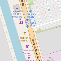

Leaflet © OpenStreetMap contributors
The heatmap indicates the level of crime in the area. The color of the heatmap indicates the crime severity and recency.
Metrics Year-on-Year
- Average area value
- 339,216.00 £Increased by 6.96 %
- Average area rental value
- 885.00 £/moDecreased by 9.51 %
- Est rental Yield
- 3.13 %Decreased by 15.41 %
- Crime Rate
- 14.00 %Unchanged by 0.00 %
from 317,140.00 £
from 978.00 £/mo
from 3.70 %
from 14.00 %
Nearby Schools
| Name | Type | Ofsted | Distance |
|---|---|---|---|
| Deyes High School | Academy Converter | Good | 0.72 KM |
| St Andrews Church Of England Primary School, Maghull | Academy Converter | 0.81 KM | |
| Green Park Primary School | Community School | Good | 0.89 KM |
| St John Bosco Catholic Primary School | Voluntary Aided School | Good | 0.95 KM |
| Maghull High School | Academy Converter | Requires improvement | 1.04 KM |
Images
Nearby Streets
| Name | Average Price | Average Sqft | Distance |
|---|---|---|---|
| Westover Road | £ 0 | 0 | 0.00 KM |
| Red Lion Close | £ 145,000 | 0 | 0.00 KM |
| BuckinghamRoad | £ 357,000 | 0 | 0.00 KM |
| Green Lane | £ 250,000 | 0 | 0.00 KM |
| Matthew Lock Way | £ 110,000 | 0 | 0.00 KM |
Nearby Transport
| Name | NLC | TLC | Distance |
|---|---|---|---|
| Maghull | 2155 | MAG | 2.01 KM |
| Maghull North | 6576 | MNS | 2.83 KM |
| Old Roan | 2258 | ORN | 3.16 KM |
| Aintree | 2125 | AIN | 4.68 KM |
| Fazakerley | 2126 | FAZ | 5.22 KM |
Nearby Listings
| Address | Price | Type | Score | Distance |
|---|---|---|---|---|
| Shop Lane, Maghull | £ 229,950 | BUY | 6 / 10 | 0.10 KM |
| Liverpool Road North, Liverpool, Merseyside, L31 | £ 100,000 | BUY | 5 / 10 | 0.11 KM |
| Liverpool Road North, Liverpool, Merseyside, L31 | £ 80,000 | BUY | 6 / 10 | 0.11 KM |
| Cornmill Lodge, Liverpool Road North, Merseyside, L31 | £ 75,000 | BUY | 5 / 10 | 0.11 KM |
| Greenville Drive, Maghull | £ 235,000 | BUY | 6 / 10 | 0.14 KM |
Nearby Properties
| Address | Price | Distance |
|---|---|---|
| 1 Westover Close | £ 338,000 | 0.00 KM |
| 4 Westover Close | £ 172,500 | 0.00 KM |
| 9 Westover Close | £ 94,500 | 0.05 KM |
| 1c Westover Close | £ 243,500 | 0.05 KM |
| 10 Westover Close | £ 164,000 | 0.05 KM |