UN
125 Alt Road
£ 190,000
Description
We don't have a Description for this property.
- Bedrooms
- 3
- Bathrooms
- 0
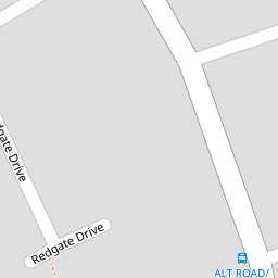


Leaflet © OpenStreetMap contributors
The heatmap indicates the level of crime in the area. The color of the heatmap indicates the crime severity and recency.
Metrics Year-on-Year
- Average area value
- 191,154.00 £Decreased by 45.17 %
- Average area rental value
- 1,267.00 £/moIncreased by 0.48 %
- Est rental Yield
- 7.95 %Increased by 83.18 %
- Crime Rate
- 8.00 %Unchanged by 0.00 %
from 348,637.00 £
from 1,261.00 £/mo
from 4.34 %
from 8.00 %
Nearby Schools
| Name | Type | Ofsted | Distance |
|---|---|---|---|
| Redgate Community Primary School | Community School | Good | 0.49 KM |
| Our Lady Of Compassion Catholic Primary School | Voluntary Aided School | Good | 0.62 KM |
| Freshfield Children'S Centre | Children's Centre | 1.07 KM | |
| Freshfield Primary School | Community School | Outstanding | 1.18 KM |
| Trinity St Peter'S Cofe Primary School | Voluntary Aided School | Good | 1.80 KM |
Images
Nearby Streets
| Name | Average Price | Average Sqft | Distance |
|---|---|---|---|
| Abbey Close | £ 0 | 0 | 0.00 KM |
| Burrow Drive | £ 0 | 0 | 0.00 KM |
| Conker Way | £ 0 | 0 | 0.00 KM |
| Broadleaf Drive | £ 0 | 0 | 0.00 KM |
| Chapelhouse Walk | £ 0 | 0 | 0.00 KM |
Nearby Transport
| Name | NLC | TLC | Distance |
|---|---|---|---|
| Formby | 2354 | FBY | 2.54 KM |
| Freshfield | 2355 | FRE | 3.02 KM |
| Hightown | 2356 | HTO | 3.24 KM |
| Ainsdale | 2350 | ANS | 5.51 KM |
| Hall Road | 2229 | HLR | 6.15 KM |
Nearby Listings
| Address | Price | Type | Score | Distance |
|---|---|---|---|---|
| Redgate Drive, Formby, Liverpool, Merseyside, L37 | £ 300,000 | BUY | 8 / 10 | 0.05 KM |
| Alt Road, Formby, Liverpool, L37 | £ 270,000 | BUY | 7 / 10 | 0.12 KM |
| Alt Road, Formby, Liverpool | £ 270,000 | BUY | Unknown | 0.14 KM |
| Cartmel Drive, Formby, Liverpool, Merseyside, L37 | £ 230,000 | BUY | 6 / 10 | 0.14 KM |
| Alt Road, Formby, Liverpool, Merseyside, L37 | £ 220,000 | BUY | 6 / 10 | 0.15 KM |
Nearby Properties
| Address | Price | Distance |
|---|---|---|
| 125 Alt Road | £ 190,000 | 0.00 KM |
| 3 Redgate Drive | £ 207,500 | 0.05 KM |
| 14 Redgate Drive | £ 170,000 | 0.05 KM |
| 11 Redgate Drive | £ 178,500 | 0.05 KM |
| 9 Kirkstall Drive | £ 148,000 | 0.14 KM |