UN
120 Damfield Lane
£ 280,000
Description
We don't have a Description for this property.
- Bedrooms
- 3
- Bathrooms
- 0
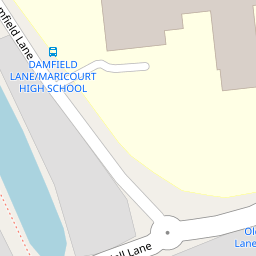

Leaflet © OpenStreetMap contributors
The heatmap indicates the level of crime in the area. The color of the heatmap indicates the crime severity and recency.
Metrics Year-on-Year
- Average area value
- 257,222.00 £Decreased by 8.17 %
- Average area rental value
- 1,100.00 £/moIncreased by 7.32 %
- Est rental Yield
- 5.13 %Increased by 16.86 %
- Crime Rate
- 4.00 %Unchanged by 0.00 %
from 280,098.00 £
from 1,025.00 £/mo
from 4.39 %
from 4.00 %
Nearby Schools
| Name | Type | Ofsted | Distance |
|---|---|---|---|
| Maricourt Catholic High School | Voluntary Aided School | Requires improvement | 0.06 KM |
| St George'S Catholic Primary School | Voluntary Aided School | Good | 0.50 KM |
| St Andrews Church Of England Primary School, Maghull | Academy Converter | 0.54 KM | |
| Deyes High School | Academy Converter | Good | 0.71 KM |
| Hudson Primary School | Community School | Good | 0.80 KM |
Images
Nearby Streets
| Name | Average Price | Average Sqft | Distance |
|---|---|---|---|
| The Meadows | £ 0 | 0 | 0.00 KM |
| Little Acre | £ 585,000 | 0 | 0.00 KM |
| Fir Cotes | £ 0 | 0 | 0.00 KM |
| BuckinghamRoad | £ 357,000 | 0 | 0.00 KM |
| Buckingham Road | £ 0 | 0 | 0.00 KM |
Nearby Transport
| Name | NLC | TLC | Distance |
|---|---|---|---|
| Maghull | 2155 | MAG | 0.89 KM |
| Maghull North | 6576 | MNS | 2.15 KM |
| Old Roan | 2258 | ORN | 2.72 KM |
| Aintree | 2125 | AIN | 4.26 KM |
| Fazakerley | 2126 | FAZ | 4.33 KM |
Nearby Listings
| Address | Price | Type | Score | Distance |
|---|---|---|---|---|
| Damfield Lane, Maghull L31 3EL | £ 360,000 | BUY | 6 / 10 | 0.01 KM |
| Aisthorpe Grove, Maghull, L31 5PN | £ 300,000 | BUY | 7 / 10 | 0.25 KM |
| St. Andrews Close, Liverpool, L31 | £ 585,000 | BUY | 8 / 10 | 0.27 KM |
| Hornby Chase, Maghull | £ 325,000 | BUY | 8 / 10 | 0.28 KM |
| St. Andrews Close, Liverpool | £ 600,000 | BUY | 8 / 10 | 0.32 KM |
Nearby Properties
| Address | Price | Distance |
|---|---|---|
| 88 Damfield Lane | £ 480,000 | 0.00 KM |
| 126 Damfield Lane | £ 347,000 | 0.00 KM |
| 120 Damfield Lane | £ 280,000 | 0.00 KM |
| 100 Hall Lane | £ 88,000 | 0.17 KM |
| 102 Hall Lane | £ 225,000 | 0.17 KM |