UN
61 Town Lane
£ 147,500
Description
We don't have a Description for this property.
- Bedrooms
- 4
- Bathrooms
- 0
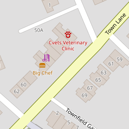

Leaflet © OpenStreetMap contributors
The heatmap indicates the level of crime in the area. The color of the heatmap indicates the crime severity and recency.
Metrics Year-on-Year
- Average area value
- 281,362.00 £Decreased by 5.90 %
- Average area rental value
- 893.00 £/moIncreased by 11.21 %
- Est rental Yield
- 3.81 %Increased by 18.32 %
- Crime Rate
- 4.00 %Unchanged by 0.00 %
from 299,019.00 £
from 803.00 £/mo
from 3.22 %
from 4.00 %
Nearby Schools
| Name | Type | Ofsted | Distance |
|---|---|---|---|
| St John'S Catholic Junior School | Voluntary Aided School | Good | 0.62 KM |
| St John'S Catholic Infant School | Voluntary Aided School | Outstanding | 0.67 KM |
| Co-Op Academy Bebington | Academy Sponsor Led | 0.78 KM | |
| St Andrew'S Cofe Aided Primary School | Voluntary Aided School | Outstanding | 0.80 KM |
| St John Plessington Catholic College | Academy Converter | Outstanding | 0.84 KM |
Images
Nearby Streets
| Name | Average Price | Average Sqft | Distance |
|---|---|---|---|
| Woodland Grove | £ 425,000 | 0 | 0.00 KM |
| Kendal Close | £ 235,000 | 0 | 0.00 KM |
| Richardson Road | £ 130,000 | 0 | 0.00 KM |
| Ascot Drive | £ 0 | 0 | 0.00 KM |
| Wellington Road | £ 312,500 | 0 | 0.00 KM |
Nearby Transport
| Name | NLC | TLC | Distance |
|---|---|---|---|
| Bebington | 2188 | BEB | 1.24 KM |
| Rock Ferry | 2189 | RFY | 1.48 KM |
| Port Sunlight | 2198 | PSL | 2.19 KM |
| Green Lane | 2218 | GNL | 2.60 KM |
| Spital | 2199 | SPI | 3.19 KM |
Nearby Listings
| Address | Price | Type | Score | Distance |
|---|---|---|---|---|
| Town Lane, Bebington, CH63 5RN | £ 55,000 | BUY | 5 / 10 | 0.06 KM |
| Townfield Gardens, Wirral | £ 75,000 | BUY | 5 / 10 | 0.06 KM |
| Town Lane, Bebington, CH63 | £ 260,000 | BUY | 7 / 10 | 0.07 KM |
| Silverdale Road, CH63 | £ 165,000 | BUY | 7 / 10 | 0.22 KM |
| Ffrancon Drive, Higher Bebington, Wirral | £ 260,000 | BUY | 7 / 10 | 0.22 KM |
Nearby Properties
| Address | Price | Distance |
|---|---|---|
| 61 Town Lane | £ 147,500 | 0.00 KM |
| 8 Townfield Gardens | £ 40,000 | 0.06 KM |
| 14 Townfield Gardens | £ 63,000 | 0.06 KM |
| 9 Townfield Gardens | £ 41,000 | 0.06 KM |
| 11 Townfield Gardens | £ 71,500 | 0.06 KM |