UN
7 Welland Road
£ 138,000
Description
We don't have a Description for this property.
- Bedrooms
- 2
- Bathrooms
- 0
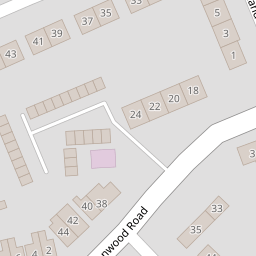

Leaflet © OpenStreetMap contributors
The heatmap indicates the level of crime in the area. The color of the heatmap indicates the crime severity and recency.
Metrics Year-on-Year
- Average area value
- 295,000.00 £Increased by 4.15 %
- Average area rental value
- 981.00 £/moDecreased by 11.94 %
- Est rental Yield
- 3.99 %Decreased by 15.47 %
- Crime Rate
- 8.00 %Unchanged by 0.00 %
from 283,244.00 £
from 1,114.00 £/mo
from 4.72 %
from 8.00 %
Nearby Schools
| Name | Type | Ofsted | Distance |
|---|---|---|---|
| Town Lane Infant School | Academy Converter | 0.67 KM | |
| Bebington Children'S Centre | Children's Centre Linked Site | 0.67 KM | |
| Higher Bebington Junior School | Community School | Outstanding | 0.76 KM |
| Brackenwood Junior School | Academy Converter | 0.78 KM | |
| Co-Op Academy Bebington | Academy Sponsor Led | 1.03 KM |
Images
Nearby Streets
| Name | Average Price | Average Sqft | Distance |
|---|---|---|---|
| Lime Avenue | £ 230,000 | 0 | 0.00 KM |
| Hazel Grove | £ 240,000 | 0 | 0.00 KM |
| St Edmunds Road | £ 420,000 | 0 | 0.00 KM |
| Ascot Drive | £ 0 | 0 | 0.00 KM |
| Kendal Close | £ 235,000 | 0 | 0.00 KM |
Nearby Transport
| Name | NLC | TLC | Distance |
|---|---|---|---|
| Bebington | 2188 | BEB | 2.38 KM |
| Rock Ferry | 2189 | RFY | 2.85 KM |
| Port Sunlight | 2198 | PSL | 2.86 KM |
| Spital | 2199 | SPI | 3.52 KM |
| Green Lane | 2218 | GNL | 3.73 KM |
Nearby Listings
| Address | Price | Type | Score | Distance |
|---|---|---|---|---|
| Derwent Road, Wirral, CH63 | £ 250,000 | BUY | 7 / 10 | 0.11 KM |
| Ferns Road, WIRRAL, Merseyside, CH63 | £ 220,000 | BUY | 7 / 10 | 0.15 KM |
| Wilstan Avenue, Bebington | £ 185,000 | BUY | Unknown | 0.21 KM |
| Teehey Lane, Bebington | £ 300,000 | BUY | 8 / 10 | 0.23 KM |
| Derwent Road, Bebington | £ 250,000 | BUY | 6 / 10 | 0.24 KM |
Nearby Properties
| Address | Price | Distance |
|---|---|---|
| 7 Welland Road | £ 138,000 | 0.00 KM |
| 6 Derwent Road | £ 149,995 | 0.05 KM |
| 6 Welland Road | £ 218,000 | 0.05 KM |
| 8 Derwent Close | £ 131,000 | 0.09 KM |
| 4 Derwent Close | £ 225,000 | 0.09 KM |