UN
7 Crossways
£ 136,500
Description
We don't have a Description for this property.
- Bedrooms
- 3
- Bathrooms
- 0
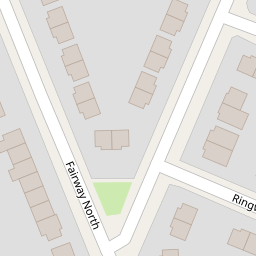


Leaflet © OpenStreetMap contributors
The heatmap indicates the level of crime in the area. The color of the heatmap indicates the crime severity and recency.
Metrics Year-on-Year
- Average area value
- 205,976.00 £Decreased by 1.36 %
- Average area rental value
- 818.00 £/moIncreased by 8.63 %
- Est rental Yield
- 4.77 %Increased by 10.16 %
- Crime Rate
- 19.00 %Unchanged by 0.00 %
from 208,824.00 £
from 753.00 £/mo
from 4.33 %
from 19.00 %
Nearby Schools
| Name | Type | Ofsted | Distance |
|---|---|---|---|
| Co-Op Academy Woodslee | Academy Sponsor Led | 0.89 KM | |
| Bromborough Children'S Centre | Children's Centre | 1.61 KM | |
| Mendell Primary School | Community School | Requires improvement | 1.90 KM |
| Church Drive Primary School | Academy Converter | 2.02 KM | |
| Christ The King Catholic Primary School | Voluntary Aided School | Good | 2.24 KM |
Images
Nearby Streets
| Name | Average Price | Average Sqft | Distance |
|---|---|---|---|
| Greenway | £ 220,000 | 0 | 0.00 KM |
| Mill Road | £ 625,000 | 0 | 0.00 KM |
| High Street | £ 0 | 0 | 0.00 KM |
| Howard Avenue | £ 249,950 | 0 | 0.00 KM |
| Otter Tunnel | £ 0 | 0 | 0.00 KM |
Nearby Transport
| Name | NLC | TLC | Distance |
|---|---|---|---|
| Spital | 2199 | SPI | 1.43 KM |
| Bromborough Rake | 2191 | BMR | 1.76 KM |
| Port Sunlight | 2198 | PSL | 1.93 KM |
| Bromborough | 2190 | BOM | 2.49 KM |
| Bebington | 2188 | BEB | 2.90 KM |
Nearby Listings
| Address | Price | Type | Score | Distance |
|---|---|---|---|---|
| Ringways,Wirral,CH62 3NG | £ 210,000 | BUY | Unknown | 0.06 KM |
| Crossways, Bromborough, CH62 | £ 189,995 | BUY | 7 / 10 | 0.08 KM |
| Western Avenue, Bromborough | £ 200,000 | BUY | 6 / 10 | 0.15 KM |
| Western Avenue, Bromborough, Wirral | £ 190,000 | BUY | Unknown | 0.16 KM |
| Eastern Avenue, Bromborough, Wirral | £ 195,000 | BUY | Unknown | 0.21 KM |
Nearby Properties
| Address | Price | Distance |
|---|---|---|
| 7 Crossways | £ 136,500 | 0.00 KM |
| 21 Crossways | £ 216,000 | 0.00 KM |
| 19 Crossways | £ 158,000 | 0.00 KM |
| 4 Northways | £ 114,500 | 0.05 KM |
| 1 Northways | £ 190,226 | 0.05 KM |