UN
14 Rocky Lane
£ 325,000
Description
We don't have a Description for this property.
- Bedrooms
- 3
- Bathrooms
- 0
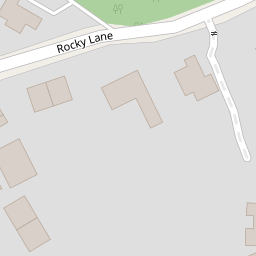


Leaflet © OpenStreetMap contributors
The heatmap indicates the level of crime in the area. The color of the heatmap indicates the crime severity and recency.
Metrics Year-on-Year
- Average area value
- 614,428.00 £Increased by 5.11 %
- Average area rental value
- 1,569.00 £/moIncreased by 44.21 %
- Est rental Yield
- 3.06 %Increased by 37.22 %
- Crime Rate
- 3.00 %Unchanged by 0.00 %
from 584,545.00 £
from 1,088.00 £/mo
from 2.23 %
from 3.00 %
Nearby Schools
| Name | Type | Ofsted | Distance |
|---|---|---|---|
| Heswall St Peter'S Cofe Primary School | Voluntary Aided School | Good | 0.44 KM |
| Gayton Primary School | Community School | Good | 0.81 KM |
| Heswall Primary School | Community School | Good | 1.19 KM |
| Stanley School | Community Special School | Good | 1.77 KM |
| Pensby Primary School | Community School | Good | 1.82 KM |
Images
Nearby Streets
| Name | Average Price | Average Sqft | Distance |
|---|---|---|---|
| Brow Lane | £ 1,200,000 | 0 | 0.00 KM |
| Telegraph Road | £ 106,950 | 0 | 0.00 KM |
| Heath Drive | £ 450,000 | 0 | 0.00 KM |
| Meadway | £ 600,000 | 0 | 0.00 KM |
| Grove Avenue | £ 0 | 0 | 0.00 KM |
Nearby Transport
| Name | NLC | TLC | Distance |
|---|---|---|---|
| Heswall | 2138 | HSW | 2.78 KM |
| Neston | 2139 | NES | 5.43 KM |
| Upton (Merseyside) | 2141 | UPT | 6.95 KM |
| Leasowe | 2237 | LSW | 9.16 KM |
| Moreton (Merseyside) | 2151 | MRT | 9.22 KM |
Nearby Listings
| Address | Price | Type | Score | Distance |
|---|---|---|---|---|
| Rocky Lane, Heswall, Wirral | £ 650,000 | BUY | Unknown | 0.11 KM |
| Dawstone Rise, Heswall, Wirral, CH60 | £ 600,000 | BUY | 8 / 10 | 0.12 KM |
| Mount Avenue, Heswall, Wirral | £ 280,000 | BUY | Unknown | 0.14 KM |
| Mount Avenue, Heswall, Wirral | £ 280,000 | BUY | 7 / 10 | 0.16 KM |
| Mount Avenue, Heswall, Wirral | £ 335,000 | BUY | 6 / 10 | 0.18 KM |
Nearby Properties
| Address | Price | Distance |
|---|---|---|
| Hill Cottage | £ 440,000 | 0.00 KM |
| Hatfield | £ 365,000 | 0.00 KM |
| Hill Lodge | £ 355,000 | 0.00 KM |
| Overdee | £ 450,000 | 0.00 KM |
| 14 Rocky Lane | £ 325,000 | 0.00 KM |