UN
1 Banbury Way
£ 150,000
Description
We don't have a Description for this property.
- Bedrooms
- 3
- Bathrooms
- 0
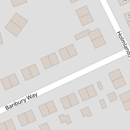


Leaflet © OpenStreetMap contributors
The heatmap indicates the level of crime in the area. The color of the heatmap indicates the crime severity and recency.
Metrics Year-on-Year
- Average area value
- 245,042.00 £Decreased by 7.12 %
- Average area rental value
- 861.00 £/moIncreased by 13.29 %
- Est rental Yield
- 4.22 %Increased by 21.97 %
- Crime Rate
- 4.00 %Unchanged by 0.00 %
from 263,830.00 £
from 760.00 £/mo
from 3.46 %
from 4.00 %
Nearby Schools
| Name | Type | Ofsted | Distance |
|---|---|---|---|
| Townfield Primary School | Academy Converter | Good | 0.52 KM |
| Prenton Children'S Centre | Children's Centre Linked Site | 1.01 KM | |
| St Michael And All Angels Catholic Primary School | Voluntary Aided School | Good | 1.28 KM |
| Prenton Primary School | Community School | Good | 1.29 KM |
| Foxfield School | Community Special School | Good | 1.44 KM |
Images
Nearby Streets
| Name | Average Price | Average Sqft | Distance |
|---|---|---|---|
| Stretton Close | £ 250,000 | 0 | 0.00 KM |
| Hargrave Avenue | £ 155,000 | 0 | 0.00 KM |
| OvertonClose | £ 250,000 | 0 | 0.00 KM |
| Budworth Road | £ 0 | 0 | 0.00 KM |
| Mill Hill | £ 0 | 0 | 0.00 KM |
Nearby Transport
| Name | NLC | TLC | Distance |
|---|---|---|---|
| Upton (Merseyside) | 2141 | UPT | 2.86 KM |
| Birkenhead North | 2145 | BKN | 3.57 KM |
| Birkenhead Park | 2220 | BKP | 3.76 KM |
| Bidston | 2136 | BID | 4.43 KM |
| Birkenhead Central | 2217 | BKC | 4.91 KM |
Nearby Listings
| Address | Price | Type | Score | Distance |
|---|---|---|---|---|
| Banbury Way, Prenton, CH43 | £ 240,000 | BUY | 6 / 10 | 0.02 KM |
| Ledbury Close, Prenton | £ 299,000 | BUY | 6 / 10 | 0.05 KM |
| Holmlands Drive, Prenton | £ 259,950 | BUY | 7 / 10 | 0.13 KM |
| Prestbury Avenue, Prenton, Merseyside, Wirral, CH43 | £ 200,000 | BUY | 5 / 10 | 0.20 KM |
| Holmlands Drive, Prenton, CH43 | £ 215,000 | BUY | 6 / 10 | 0.20 KM |
Nearby Properties
| Address | Price | Distance |
|---|---|---|
| 29 Banbury Way | £ 180,000 | 0.00 KM |
| 16 Banbury Way | £ 150,000 | 0.00 KM |
| 15 Banbury Way | £ 130,000 | 0.00 KM |
| 1 Banbury Way | £ 150,000 | 0.00 KM |
| 7 Banbury Way | £ 215,000 | 0.00 KM |