UN
10 Dovedale Close
£ 130,000
Description
We don't have a Description for this property.
- Bedrooms
- 3
- Bathrooms
- 0
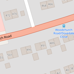

Leaflet © OpenStreetMap contributors
The heatmap indicates the level of crime in the area. The color of the heatmap indicates the crime severity and recency.
Metrics Year-on-Year
- Average area value
- 416,667.00 £Increased by 57.08 %
- Average area rental value
- 735.00 £/moDecreased by 0.41 %
- Est rental Yield
- 2.12 %Decreased by 36.53 %
- Crime Rate
- 3.00 %Unchanged by 0.00 %
from 265,251.00 £
from 738.00 £/mo
from 3.34 %
from 3.00 %
Nearby Schools
| Name | Type | Ofsted | Distance |
|---|---|---|---|
| Prenton Children'S Centre | Children's Centre Linked Site | 0.49 KM | |
| Oxton St Saviour'S Cofe Aided Primary School | Voluntary Aided School | Good | 0.69 KM |
| Prenton Primary School | Community School | Good | 0.74 KM |
| Townfield Primary School | Academy Converter | Good | 1.11 KM |
| Birkenhead School | Other Independent School | 1.31 KM |
Images
Nearby Streets
| Name | Average Price | Average Sqft | Distance |
|---|---|---|---|
| Redwood Close | £ 0 | 0 | 0.00 KM |
| OvertonClose | £ 250,000 | 0 | 0.00 KM |
| Mill Hill | £ 0 | 0 | 0.00 KM |
| Bryanston Road | £ 630,000 | 0 | 0.00 KM |
| Hargrave Avenue | £ 155,000 | 0 | 0.00 KM |
Nearby Transport
| Name | NLC | TLC | Distance |
|---|---|---|---|
| Birkenhead Park | 2220 | BKP | 3.21 KM |
| Birkenhead North | 2145 | BKN | 3.50 KM |
| Upton (Merseyside) | 2141 | UPT | 3.59 KM |
| Birkenhead Central | 2217 | BKC | 4.11 KM |
| Conway Park | 3624 | CNP | 4.20 KM |
Nearby Listings
| Address | Price | Type | Score | Distance |
|---|---|---|---|---|
| Woodchurch Road, Prenton, Merseyside, Wirral, CH43 | £ 260,000 | BUY | Unknown | 0.16 KM |
| Tilstock Crescent, Prenton | £ 350,000 | BUY | Unknown | 0.22 KM |
| Pulford Avenue, Prenton, Merseyside, CH43 | £ 350,000 | BUY | 6 / 10 | 0.23 KM |
| Tarporley Close, Prenton, CH43 | £ 280,000 | BUY | Unknown | 0.29 KM |
| Cumberland Avenue, Prenton | £ 249,950 | BUY | 7 / 10 | 0.30 KM |
Nearby Properties
| Address | Price | Distance |
|---|---|---|
| 6 Dovedale Close | £ 186,000 | 0.00 KM |
| 10 Dovedale Close | £ 130,000 | 0.00 KM |
| 11 Dovedale Close | £ 92,000 | 0.00 KM |
| 12 Dovedale Close | £ 161,000 | 0.00 KM |
| 4 Dovedale Close | £ 125,000 | 0.00 KM |