UN
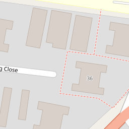
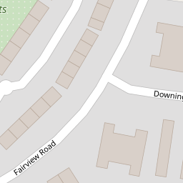
68 Downing Close
£ 87,000
Description
We don't have a Description for this property.
- Bedrooms
- 1
- Bathrooms
- 0
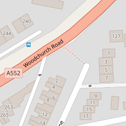

Leaflet © OpenStreetMap contributors
The heatmap indicates the level of crime in the area. The color of the heatmap indicates the crime severity and recency.
Metrics Year-on-Year
- Average area value
- 245,042.00 £Decreased by 7.12 %
- Average area rental value
- 861.00 £/moIncreased by 13.29 %
- Est rental Yield
- 4.22 %Increased by 21.97 %
- Crime Rate
- 5.00 %Unchanged by 0.00 %
from 263,830.00 £
from 760.00 £/mo
from 3.46 %
from 5.00 %
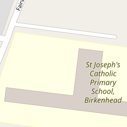
Nearby Schools
| Name | Type | Ofsted | Distance |
|---|---|---|---|
| St Joseph'S Catholic Primary School, Birkenhead | Academy Sponsor Led | 0.08 KM | |
| Prenton Preparatory School | Other Independent School | 0.59 KM | |
| Woodchurch Road Primary School | Community School | Requires improvement | 0.61 KM |
| Devonshire Park Primary School | Community School | Good | 0.65 KM |
| Oxton St Saviour'S Cofe Aided Primary School | Voluntary Aided School | Good | 1.12 KM |
Images
Nearby Streets
| Name | Average Price | Average Sqft | Distance |
|---|---|---|---|
| Highpark Road | £ 0 | 0 | 0.00 KM |
| Dudley Close | £ 0 | 0 | 0.00 KM |
| North Road | £ 95,000 | 0 | 0.00 KM |
| Bryanston Road | £ 630,000 | 0 | 0.00 KM |
| Columbia Lane | £ 850,000 | 0 | 0.00 KM |
Nearby Transport
| Name | NLC | TLC | Distance |
|---|---|---|---|
| Birkenhead Park | 2220 | BKP | 2.44 KM |
| Birkenhead Central | 2217 | BKC | 2.52 KM |
| Green Lane | 2218 | GNL | 2.71 KM |
| Conway Park | 3624 | CNP | 2.73 KM |
| Rock Ferry | 2189 | RFY | 3.21 KM |
Nearby Listings
| Address | Price | Type | Score | Distance |
|---|---|---|---|---|
| Downing Close, Prenton, Merseyside, CH43 | £ 90,000 | BUY | 4 / 10 | 0.00 KM |
| Downing Close, Prenton | £ 110,000 | BUY | 5 / 10 | 0.01 KM |
| Downing Close, Prenton | £ 112,500 | BUY | 5 / 10 | 0.04 KM |
| Woodchurch Road, Prenton, CH42 | £ 150,000 | BUY | 6 / 10 | 0.17 KM |
| 98 WOODCHURCH LANE, PRENTON | £ 120,000 | BUY | Unknown | 0.18 KM |
Nearby Properties
| Address | Price | Distance |
|---|---|---|
| 49 Downing Close | £ 78,000 | 0.00 KM |
| 59 Downing Close | £ 64,000 | 0.00 KM |
| 27 Downing Close | £ 72,000 | 0.00 KM |
| 68 Downing Close | £ 87,000 | 0.00 KM |
| 57 Downing Close | £ 88,500 | 0.00 KM |