UN
6 Broxton Avenue
£ 203,000
Description
We don't have a Description for this property.
- Bedrooms
- 4
- Bathrooms
- 0
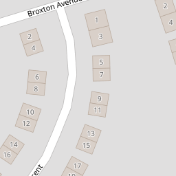

Leaflet © OpenStreetMap contributors
The heatmap indicates the level of crime in the area. The color of the heatmap indicates the crime severity and recency.
Metrics Year-on-Year
- Average area value
- 287,500.00 £Increased by 19.71 %
- Average area rental value
- 850.00 £/moIncreased by 25.00 %
- Est rental Yield
- 3.55 %Increased by 4.41 %
- Crime Rate
- 3.00 %Unchanged by 0.00 %
from 240,163.00 £
from 680.00 £/mo
from 3.40 %
from 3.00 %
Nearby Schools
| Name | Type | Ofsted | Distance |
|---|---|---|---|
| Prenton Children'S Centre | Children's Centre Linked Site | 0.37 KM | |
| Prenton Primary School | Community School | Good | 0.61 KM |
| Oxton St Saviour'S Cofe Aided Primary School | Voluntary Aided School | Good | 0.72 KM |
| Townfield Primary School | Academy Converter | Good | 1.22 KM |
| Prenton Preparatory School | Other Independent School | 1.37 KM |
Images
Nearby Streets
| Name | Average Price | Average Sqft | Distance |
|---|---|---|---|
| Redwood Close | £ 0 | 0 | 0.00 KM |
| OvertonClose | £ 250,000 | 0 | 0.00 KM |
| Bryanston Road | £ 630,000 | 0 | 0.00 KM |
| Mill Hill | £ 0 | 0 | 0.00 KM |
| Hargrave Avenue | £ 155,000 | 0 | 0.00 KM |
Nearby Transport
| Name | NLC | TLC | Distance |
|---|---|---|---|
| Birkenhead Park | 2220 | BKP | 3.27 KM |
| Birkenhead North | 2145 | BKN | 3.63 KM |
| Upton (Merseyside) | 2141 | UPT | 3.70 KM |
| Birkenhead Central | 2217 | BKC | 4.10 KM |
| Conway Park | 3624 | CNP | 4.20 KM |
Nearby Listings
| Address | Price | Type | Score | Distance |
|---|---|---|---|---|
| Tilstock Crescent, Prenton | £ 350,000 | BUY | Unknown | 0.09 KM |
| Woodchurch Road, Prenton, Merseyside, Wirral, CH43 | £ 260,000 | BUY | Unknown | 0.10 KM |
| Pulford Avenue, Prenton, Merseyside, CH43 | £ 350,000 | BUY | 6 / 10 | 0.12 KM |
| Northwood Road, Prenton, Wirral | £ 275,000 | BUY | Unknown | 0.24 KM |
| Cumberland Avenue, Prenton | £ 249,950 | BUY | 7 / 10 | 0.28 KM |
Nearby Properties
| Address | Price | Distance |
|---|---|---|
| 20 Broxton Avenue | £ 199,950 | 0.00 KM |
| 24 Broxton Avenue | £ 295,000 | 0.00 KM |
| 2 Broxton Avenue | £ 329,000 | 0.00 KM |
| 6 Broxton Avenue | £ 203,000 | 0.00 KM |
| 50 Broxton Avenue | £ 152,000 | 0.00 KM |